


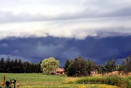
Snow and thunder collide over Alberta and Saskatchewan
Monday, May 12 marked the return of widespread rainfall across the western Prairies, especially in Alberta and Saskatchewan, alongside powerful thunderstorms and late-season snowfall. The evolving weather conditions are creating hazardous travel across the region, particularly at higher elevations.
Heavy snow blankets Alberta’s Rockies and high terrain
Along Highway 93 near Kananaskis, and through regions above 1600 metres elevation, heavy, wet snow fell throughout the day on Monday. Environment and Climate Change Canada (ECCC) issued snowfall warnings, noting that visibility could deteriorate rapidly and that road conditions may worsen quickly. By Tuesday morning, snow-covered peaks are expected across Alberta’s mountain ranges, with the freezing level dipping below 1800 metres.
Severe thunderstorms and tornado threats in Saskatchewan
By late Monday, southern Saskatchewan faced a line of strong storms moving in from Montana, triggering tornado warnings—though no tornadoes have yet been confirmed. The threat of damaging wind gusts and large hail will persist through the overnight hours into Tuesday, with central parts of Saskatchewan facing the greatest storm risk.
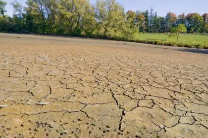
Significant rainfall totals across Alberta
The long-awaited precipitation is helping to make up for the extreme fire risk conditions that opened the wildfire season. Between Monday and Tuesday, forecasts include:
- 20–30 mm of rain in Calgary
- Higher totals expected between Red Deer and Hinton
- Localized amounts could reach 50 mm
From Fort McMurray down to the southern foothills, another wave of showers and embedded thunderstorms is expected on Wednesday, brought in by a storm system descending from the north.
Dramatic contrast: snow in the west, summer heat in the east
A sharp west-to-east temperature gradient is dominating the Prairies early this week. While a cold upper low spreads accumulating snow and unseasonably cold temperatures across Alberta, a ridge of high pressure over Manitoba is delivering record heat, with daytime highs soaring into the 30s°C (86+°F).
Calgary still recovering from dry May
As of May 11, Calgary International Airport had yet to record measurable rainfall this month. Historically, May ranks as the third-wettest month of the year, behind June and July. While the current week’s precipitation won’t fully erase the rainfall deficit, it is expected to make a meaningful dent in the shortfall.


