


Severe thunderstorm watch still active in southeastern Manitoba
OTTAWA, Saturday, June 28, 2025 — A Severe Thunderstorm Watch remains in effect this evening across southeastern Manitoba, following hail and signs of rotating cloud formations earlier this afternoon. Environment Canada issued the alert for areas including the Rural Municipality of Hanover, Steinbach, Niverville, and Grunthal, as hot and unstable air continues to fuel intense storm activity across the region.
Unsettled skies across Interlake and the Red River Valley
Conditions across the Interlake, the Red River Valley, and eastern Manitoba remain humid and volatile, creating a highly favourable environment for the development of severe thunderstorms through the evening hours. These unstable patterns have already begun producing dangerous phenomena.
Hail strikes Dominion City, cloud rotation spotted near St. Malo
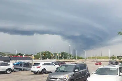
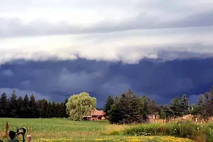
At approximately 3:30 p.m. local time, hail was observed in Dominion City, with residents reporting ice pellets accumulating on patios and yards. Simultaneously, rotational movement was reported in the cloud base near St. Malo, a potential precursor to more severe storm development.
Photos shared on social media and through #MBStorm show large hailstones damaging outdoor furniture. Swirling cloud formations above highways near St. Malo have prompted increased scrutiny from local meteorologists and storm chasers.
Storms capable of producing violent winds and large hail
Environment Canada warns that some of today’s storms may deliver destructive wind gusts and hailstones as large as baseballs. The agency stresses that these systems can lead to serious property damage, destruction of trees, and potentially life-threatening injuries.
“These storms can damage property, buildings and large stands of trees,” reads the official bulletin. “There is a risk of life-threatening injury.”
Severe thunderstorm watches: what they mean
A Severe Thunderstorm Watch signals that the atmospheric conditions are ripe for the formation of dangerous weather, including damaging hail, high winds, and torrential rainfall. These watches often precede more urgent warnings when storms become imminent.
Lightning, debris, and hail remain active threats
Frequent lightning, combined with the risk of flying debris and blunt-force hail, underscores the extreme caution urged for anyone caught outdoors. Popcorn-like cloud formation