


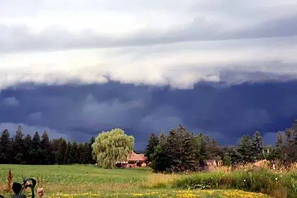
Southern Alberta and parts of southwestern Saskatchewan are bracing for a round of severe thunderstorms today, with the potential for funnel clouds and localized damaging weather despite the lingering cooler temperatures.
Storms gaining strength as they move east
A cluster of thunderstorms has already pushed through portions of southern Alberta this morning. So far, these storms have been relatively tame, but conditions are expected to become more favourable for severe development by this afternoon. As the system continues to move east-southeast, new storm cells are also likely to form closer to the Canada–U.S. border later in the day, and these too are expected to intensify.
By late afternoon and into the evening hours, these storms will likely track into southwestern Saskatchewan, where they will linger until nightfall before drifting across the border into the U.S.
Primary threat zone in southeastern Alberta and southwestern Saskatchewan
The highest risk for severe weather today lies in southeastern Alberta and southwestern Saskatchewan, highlighted in yellow on the forecast map. In this corridor, forecasters are warning of strong wind gusts and hail roughly the size of Timbits.
A broader region — marked in green — which includes much of the remaining southern Alberta and southwestern Saskatchewan, is also at risk, though the severe weather threat there is somewhat lower.
Funnel cloud risk farther north
Another concern today comes from the possibility of funnel clouds forming farther north of the main storm track. According to Environment Canada, areas stretching from Calgary to Olds, then eastward toward Drumheller, Hanna, and into the Leader region of Saskatchewan, could see conditions that support these features.
While funnel clouds are typically harmless and don’t touch down, some can become weak landspout tornadoes if they connect with the ground, particularly under today’s unstable setup.


