


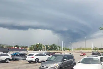
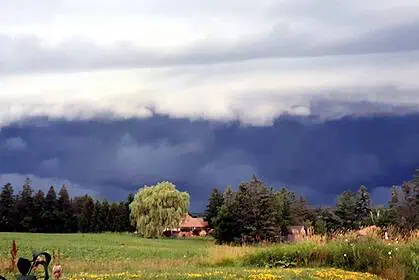
Several densely populated corridors of Alberta stare down a potent outbreak of severe thunderstorms today, with some neighbourhoods confronting the threat of gargantuan hailstones and a fleeting tornado.
Forecasters at Environment and Climate Change Canada point to outlooks from the Storm Prediction Centre, highlighting an expansive swath of central Alberta—stretching along the busy QEII and sweeping over Red Deer—where the atmosphere is primed for wind bursts reaching 110 km/h (68 mph), hailstones up to five centimetres (2 inches) across, drenching downpours totalling 30 millimetres (1.2 inches), and the spinning up of a brief twister.
A wider moderate-risk belt wraps around Edmonton, Calgary, Lloydminster, Fort McMurray, and High Level. Within this zone, sudden gusts could leap to 100 km/h (62 mph), rainfall may again touch 30 millimetres (1.2 inches), and hail could measure three centimetres (1.2 inches).
Along the province’s western rim and portions of the north, locations such as Grande Prairie, Edson, and the dramatic scenery of Banff and Jasper National Parks sit under a marginal threat. Here, thunderclouds may unleash blasts of air near 70 km/h (43 mph), ice pellets roughly two centimetres (0.8 inches) wide, and showers amounting to 30 millimetres (1.2 inches).
Meteorologists explain that convective towers are expected to ignite across northern and central sections of the province through the afternoon, then sweep eastward as an approaching upper trough digs in and a fledgling low-pressure centre organises over Alberta.


