
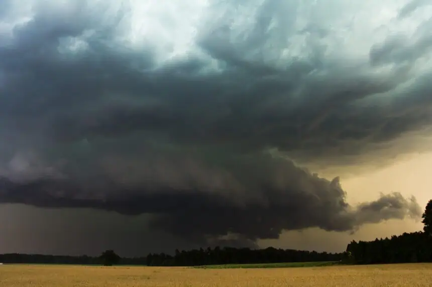

A powerful cold front is slicing through Texas, bringing with it a turbulent mix of severe storms, hail, and a dramatic drop in temperatures. This multi-state system, currently pushing through the Southern Plains, is triggering dangerous weather from the Texas Panhandle to San Antonio and the Dallas-Fort Worth area, with conditions expected to linger into the new work week.
North Texas braces for storms and flooding
Starting Sunday night, May 25, and intensifying through Memorial Day, the Dallas-Fort Worth region will see an increased risk of severe thunderstorms. Forecasts from the National Weather Service Dallas-Fort Worth office warn of potential flash flooding, with rainfall totals between 1.5 to 2.5 inches, and localized amounts up to 3.5 inches in some communities. This surge of rain follows multiple days of extreme heat, where highs neared 100°F (37.8°C). With the front’s passage, temperatures are expected to cool dramatically, settling in the upper 70s to low 80s°F (25–28°C), bringing relief to the region.
San Antonio and Hill Country face hail and flooding risk
The San Antonio metro area and surrounding Texas Hill Country are on alert as well. A 10–30% chance of strong thunderstorms looms on Sunday, with heavier storm activity likely by Monday as the front pushes southward. The National Weather Service highlights a flooding threat, particularly in drought-stricken zones, where saturated soil may quickly give way under intense downpours. Rainfall could bring minor flooding, but also much-needed moisture to the region.
Texas Panhandle sees first impact from the cold front
The Texas Panhandle, including Amarillo, will be among the first to experience the effects of this frontal system. Storms are set to begin Saturday night, with hail and damaging wind gusts listed as the primary hazards through Sunday. High temperatures in the area will plummet from the low 90s°F (32–34°C) to the low 70s°F (21–23°C) by Monday, reflecting the full impact of the front.
Rain chances continue into late week statewide
Although storm intensity may decrease, lingering rain chances persist across Texas through Thursday. The San Antonio-Austin corridor is expected to remain gloomy, with cloud cover and occasional showers as the upper-level weather pattern remains uncertain and unstable. Meanwhile, continued moisture in the Texas Panhandle could prolong soggy conditions for residents throughout the week.
Stay aware as weather conditions shift rapidly across the state, bringing hail threats, cooler days, and flood potential in various regions.


