
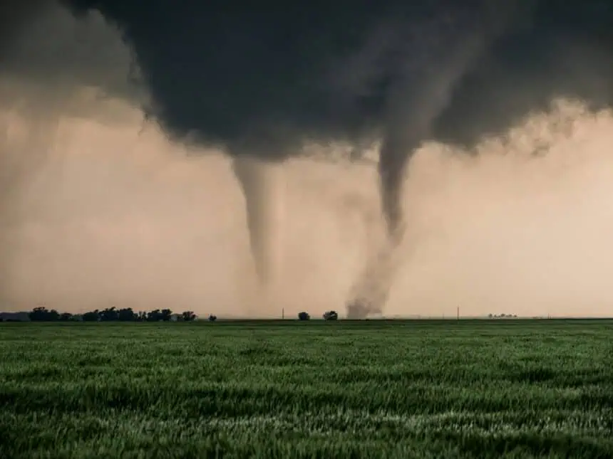

States like Texas, Oklahoma, Missouri, and Arkansas are under the threat of extreme weather conditions, just as millions of Americans hit the road for the long Memorial Day weekend. The National Weather Service (NWS) has issued warnings for severe thunderstorms, large hail, isolated tornadoes, and torrential rain, with a high risk of flash flooding especially in Oklahoma, Missouri, Arkansas, and Kansas.
Heavy rainfall and tornado threat across the central U.S.
The Texas Panhandle, Alabama, northern Mississippi, and western Tennessee are among the regions that have already faced damaging storms on Saturday and Sunday and will likely see further rounds of severe weather. These conditions are being driven by a persistent jet stream pattern, dividing warm and cold air masses and setting up a repeat storm cycle with slow-moving and intense rain bands.
The Oklahoma City metro area and northern Texas are now in an “enhanced” risk zone (level 3 out of 5) for strong winds, large hail, and potential tornadoes, according to the latest NWS updates. Rainfall totals may reach between 3 and 6 inches (7–15 cm), with even higher localized amounts, leading to landslides and dangerous flash floods.
Holiday travel disrupted by severe conditions
According to the American Automobile Association (AAA), more than 45 million people are traveling at least 55 miles (90 km) this weekend, making it one of the busiest Memorial Day holidays in recent history. However, storm-related disruptions are expected to impact key travel corridors and airports. From Dallas-Fort Worth to Little Rock, forecasters are warning of flight delays, power outages, and fallen trees blocking roadways.
The NWS stressed the danger of nighttime flooding, when it’s much harder to spot water-covered roads, warning that many flood fatalities happen inside vehicles. The core message remains: “If you see water over the road, turn around—don’t risk it.”
Stormy South, but cooler and calmer in the Northeast and Midwest
While the South deals with volatile conditions, the Northeast, including New York and New England, will experience a cool but stable weekend, with below-average temperatures and partly cloudy skies. The Midwest will also enjoy relatively calm conditions, offering a brief break from the storms.
By contrast, the Southwest—including areas of Arizona, Nevada, and Southern California—will see sunny, dry, and hot weather, while the Northwest, particularly in Washington, Oregon, and the northern Rocky Mountains, could encounter scattered showers.
High-alert zones remain under active watch
Tulsa (Oklahoma), Springfield (Missouri), Little Rock (Arkansas), and other communities are under active weather surveillance. Cities like Fayetteville and Branson, along with Douglas, Ozark, and Taney counties, are facing potential rainfall rates of up to 4 inches (10 cm) per hour, with the highest impact expected overnight Sunday into Monday.
Authorities continue to urge the public to stay informed, use official weather alert apps, and have emergency shelter plans ready in case of tornado warnings or sudden floods.
Weather alert Texas and Oklahoma: this Memorial Day weekend 2025 is shaping up to be one of the most dangerous holiday periods in recent years, as millions of travelers face a widespread and severe weather threat.


