

More storms targeting metro Atlanta later today
ATLANTA, Georgia – As Memorial Day activities unfold across Georgia, the FOX 5 Storm Team is sounding the alarm: another round of wet and possibly severe weather is on the way this afternoon and evening, particularly for metro Atlanta and North Georgia.
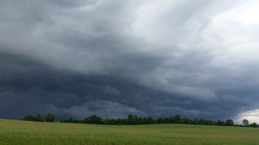
At midday, meteorologist Jonathan Stacey noted that while skies have cleared in some areas, this break is temporary. The sunshine now visible across parts of the region is just the calm before the next weather disruption. There’s currently a Level 1 out of 5 severe weather risk, but that doesn’t mean residents are off the hook.
What’s coming this afternoon and tonight
By early afternoon, scattered showers were already appearing near and south of Interstate 20, while a larger storm system over Mississippi was pushing eastward. This system is expected to bring damaging wind gusts up to 60 mph, hail up to the size of quarters, and abundant lightning to Georgia as it moves in.
While a tornado is not the primary concern, brief tornadoes can’t be ruled out. The heaviest rainfall and strongest storms are forecast between late afternoon and midnight, with another round likely on Tuesday evening.
Roads already impacted by wet conditions
This morning’s soggy commute created issues on several key roads. Crashes were reported along I-75 NB at Highway 92 near Acworth, and also on I-20 EB before Lowery Boulevard, both around 5 a.m. As of 7:30 a.m., areas that were dry were expected to remain so through late morning, offering a small window for outdoor plans before rain ramps up again.
Sunday night’s severe weather recap
On Sunday evening, severe thunderstorm warnings and tornado watches peppered the North Georgia region, impacting areas like Cherokee, Bartow, Gwinnett, Fulton, and DeKalb counties. A tornado warning was issued as far north as Gordon and Floyd counties, with a severe thunderstorm capable of producing a tornado reported 9 miles northeast of Summerville just before 7 p.m.
Thousands lost power across the region. North Georgia EMC and Georgia Power confirmed outages affecting hundreds of customers, especially in counties under severe thunderstorm watches until midnight.
Tuesday and midweek outlook
Storms will linger into early Tuesday, followed by another wave likely between 6 p.m. and 9 p.m. The high on Tuesday will be a cooler 76°F (24°C) due to extensive cloud cover and ongoing rain. By Wednesday morning, skies are expected to clear temporarily, and temperatures will rebound into the 80s°F (upper 20s°C) as rain chances slowly diminish moving into the weekend.
Keep alert, stay weather-aware
Though a brief midday lull might allow for barbecues or a visit to the Atlanta Jazz Festival, residents are urged to stay alert. The potential for sudden, strong storms remains very real this evening and overnight. The atmosphere continues to show enough instability to support frequent lightning, intense wind, and short bursts of heavy rainfall.
Stay tuned to FOX 5 Atlanta, follow @FOX5StormTeam, and download their app for real-time alerts and location-based updates.


