

Severe thunderstorm watch remains active through late Friday evening
CHARLESTON, South Carolina – As of this Friday, May 30, 2025, a severe thunderstorm watch continues to grip the entire Lowcountry region, remaining in effect until 11 p.m. Eastern Time. While earlier severe thunderstorm warnings have expired for several counties—including Berkeley, Georgetown, Dorchester, Williamsburg, and Orangeburg—the watch area still encompasses Charleston, Berkeley, Dorchester, Colleton, Beaufort, Williamsburg, and Georgetown Counties.
High storm threat and upgraded risk level across South Carolina
Earlier in the day, both the Midlands and Upstate were placed under a severe thunderstorm watch until 8 p.m., as the Storm Prediction Center elevated the statewide storm risk to an “enhanced” level—level 3 out of 5. This upgrade signals increased confidence in the development of strong to severe storms tied to a cold front pushing across the Palmetto State.
Primary threats: Winds over 60 mph and widespread damage risk
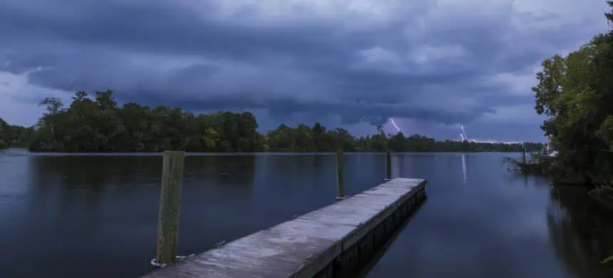
According to Live 5 First Alert Meteorologist Joey Sovine, the main concern lies in the potential for damaging wind gusts exceeding 60 mph (96 km/h). These powerful gusts are most likely to occur between 4 p.m. and 8 p.m., right along the leading edge of a broken storm line.
In addition to these wind threats, hail, intense lightning, heavy downpours, and even isolated tornadoes are possible, contributing to the volatile evening weather pattern. Wind gusts within severe storms can exceed 100 mph (160 km/h), causing widespread tree damage, downed power lines, and scattered outages across the region.
Conditions expected to improve overnight
By mid to late evening, storms are forecast to exit the coastline, leading to a gradual clearing of the skies overnight. The severe weather watch is expected to expire by 11 p.m., but residents across the Lowcountry are urged to stay alert until storms pass.
Stay connected with Live 5 First Alert Weather for ongoing updates throughout the evening as this dynamic weather situation continues to unfold across South Carolina.


