
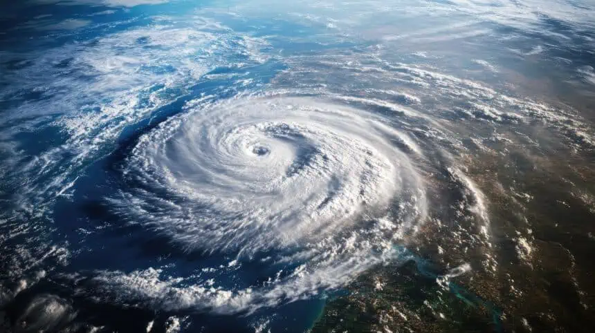

A potentially historic hurricane season begins in Florida
As of Monday, June 2, the 2025 Atlantic hurricane season has officially begun — and Florida finds itself on high alert following an urgent warning from the National Oceanic and Atmospheric Administration (NOAA). Forecasts released by NOAA point to a 60% chance of above-normal hurricane activity, placing Floridians in the crosshairs of what could be one of the most active tropical seasons in recent memory.
Why this season is different: a dangerous combination of forces
This year’s alarming forecast stems from a volatile mix of meteorological ingredients. According to NOAA, the convergence of a neutral El Niño–Southern Oscillation, unusually warm Atlantic waters, and weakened wind shear is expected to amplify storm formation and intensity. These factors have set the stage for what experts warn could be a particularly destructive season.
In a statement that underscores the seriousness of the situation, Ken Graham, director of the National Weather Service, said: “This outlook is a call to action: be prepared.” Graham emphasized that, in his three decades of service, forecasting tools have never been more advanced, but that technology alone won’t shield communities. The key, he says, is early preparation.
More storms, more intensity: what the numbers show
NOAA is forecasting 13 to 19 named storms, including six to 10 hurricanes, with up to five possibly reaching major hurricane status. This estimate is well above the historical average of 14 named storms and seven hurricanes. Reinforcing this outlook, Colorado State University projects a similarly high-activity season, predicting 17 named storms and nine hurricanes.
As residents in Florida know all too well, statistics only tell part of the story. The phrase often repeated by storm experts still rings true: “It only takes one.” That grim reminder is backed by recent memory — Hurricane Helene, which slammed the U.S. Gulf Coast in September 2024, became the deadliest hurricane to strike the mainland since Katrina in 2005, killing at least 250 people and inflicting widespread financial hardship across the Southeast.
Climate change is intensifying the danger
Evidence continues to mount that global warming is intensifying hurricanes. Scientists analyzing last year’s season found that human-driven climate change increased Hurricane Helene’s rainfall by 10% and wind strength by 11%. According to NASA climatologist Angela Colbert, the link between rising global temperatures and extreme rainfall and storm surges is now widely accepted among climate researchers.
In response, studies have proposed tangible strategies for slowing down these trends. One such analysis by Cornell University suggested that by reallocating just 3.2% of cropland used for ethanol, the U.S. could triple its solar energy output, reducing the fossil fuel emissions that help supercharge storms.
Longer warnings, better models: technology steps in
For 2025, NOAA has taken steps to increase forecast accuracy and public readiness. A model upgrade is expected to improve the tracking and intensity predictions of tropical systems by approximately 5%. Additionally, NOAA has expanded its Global Tropical Hazards Outlook, now offering three-week forecasts, rather than two. This extra lead time could be critical for communities in Florida, allowing more time to implement safety plans and mobilize emergency response resources.
As June unfolds, all eyes in Florida — from Miami to Tampa, from the Keys to Jacksonville — are on the Atlantic Basin, where the first named storm could form at any moment.


