

Early morning tornado warnings grip central and northern Oklahoma
In the early hours of Saturday, June 7, 2025, Chief Meteorologist David Payne has been actively monitoring severe storms from the Bob Mills Weather Center. The system brought intense overnight activity across large portions of Oklahoma, especially impacting Garfield, Alfalfa, Noble, Woods, Kay, and Canadian Counties.
As of 2:18 a.m. local time, multiple tornado warnings had been issued and confirmed tornado touchdowns created extensive damage, widespread power outages, and dangerous conditions throughout the region.
Winds exceed 70 mph and power outages intensify
At 2:00 a.m., the Garfield County Emergency Manager reported wind gusts up to 70 mph (113 km/h) in Pond Creek, accompanied by total power loss. A few minutes earlier, at 1:58 a.m., Cherokee and Burlington in Alfalfa County also lost power. In Burlington, a fallen tree struck a propane tank, causing a hazardous leak.
A series of tornado warnings issued across multiple counties
From 1:13 a.m. to 2:30 a.m., several tornado warnings were issued in rapid succession. These included:
- 1:13 a.m.: Alfalfa and Woods Counties
- 1:31 a.m.: Extended warning for Alfalfa County
- 1:35 a.m.: Alfalfa and Garfield Counties
- 1:54 a.m.: Expanded warning for Garfield, Kay, and Noble Counties
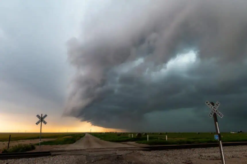
These storms, part of a larger supercell system, have been producing rotation, wall clouds, and reported tornado touchdowns across central and northwestern Oklahoma.
Tornado touches down in Sweetwater, more warnings follow
At 11:50 p.m., Val Castor confirmed a tornado on the ground in southeast Sweetwater. Following this, a warning was issued for Canadian, Cleveland, Grady, McClain, and Oklahoma County until 12:30 a.m..
Brandon Pennel, tracking from Minco, reported a developing wall cloud with tornado sirens sounding, indicating high urgency.
Storm tracker footage captures tornado activity near Minco
At 11:25 p.m., warnings were issued for Beckham and Roger Mills Counties, and by 11:15 p.m., Caddo, Canadian, and Grady Counties were placed under alerts. Earlier in the evening, Jeromy Carter, located in Butler, reported quarter-sized hail, while a tornado watch remained active for a wide region through 6 a.m..
Supercell tracks east from the panhandle
At 9:00 p.m., David Payne noted that a large supercell had left the Oklahoma Panhandle, tracking toward Roger Mills County with an estimated arrival around 10:00 p.m.. The system had the potential for golf ball-sized hail, damaging winds, and multiple tornadoes.
Meanwhile, southwestern Oklahoma faced thunderstorms near Sayre, pushing winds between 30 and 45 mph (48–72 km/h).
Real-time storm coverage continues
The situation remains dynamic. Viewers are encouraged to follow live coverage with David Payne and the News 9 Storm Trackers for the most current information on rotating cells, storm trajectories, and emergency alerts across Oklahoma.


