

Hail threat looms over North Texas this weekend
As of Saturday, June 7, the threat of large hail remains active across North Texas, particularly in western counties such as Wichita, Wilbarger, and Stephens, where storms have already delivered hailstones larger than 2 inches (5.08 cm) earlier this month. New rounds of severe thunderstorms are expected to continue through the weekend, potentially producing hail the size of golf balls (1.75 inches / 4.45 cm) or larger.
How hail forms during severe weather outbreaks
Hailstones originate within intense thunderstorm clouds, where strong updrafts lift raindrops into the upper atmosphere. There, in subfreezing temperatures, the droplets freeze, forming small hail. As the frozen core collides with supercooled water droplets, layers of ice accumulate and the hailstone grows. Eventually, gravity wins—when the updraft weakens, the stone falls to Earth. Surface winds may cause the hail to descend at an angle, worsening its potential impact.
Understanding hail compared to sleet, graupel, and snow
Unlike snow, which forms from direct sublimation of water vapor to ice, hail forms exclusively in convective storm environments. Graupel emerges when supercooled droplets freeze on snowflakes, creating soft, crumbly pellets. Sleet, meanwhile, results from rain droplets refreezing mid-descent, and typically remains under 0.2 inches (0.5 cm). Hail differs by growing through layered freezing and must exceed 0.2 inches to qualify as such.
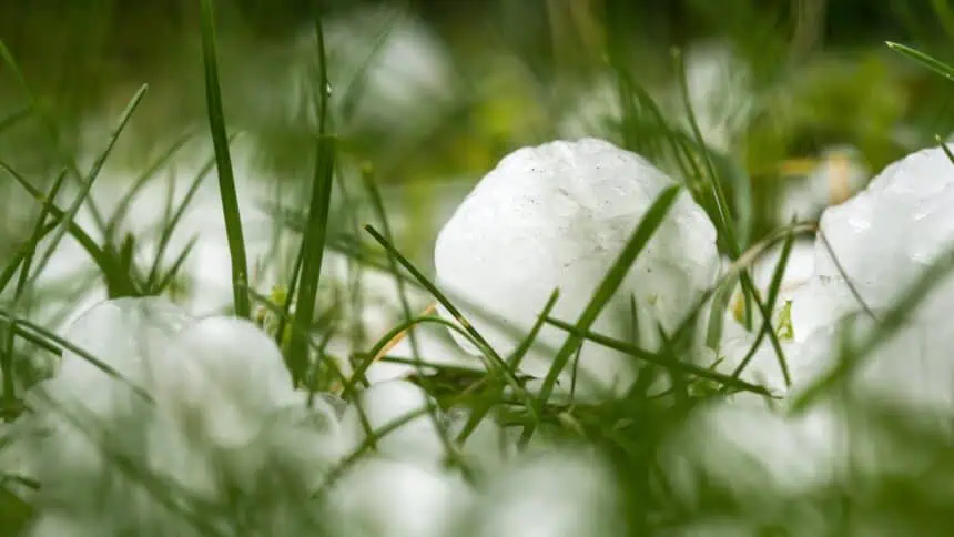
Hail size comparisons and damage potential
Here’s a reference based on National Weather Service standards from Fort Worth:
- Pea size: 0.25 inches (0.64 cm)
- Marble size: 0.50 inches (1.27 cm)
- Penny size: 0.75 inches (1.9 cm)
- Quarter size (severe threshold): 1.00 inch (2.54 cm)
- Golf ball size: 1.75 inches (4.45 cm)
- Hen egg size: 2.00 inches (5.08 cm)
- Baseball size: 2.75 inches (7 cm)
- Softball size: 4.50 inches (11.43 cm)
Hail that reaches or exceeds 1 inch in diameter (2.54 cm) is categorized as severe and can dent vehicles, crack windows, shred foliage, and damage roofs.
Protecting yourself during hailstorms
If caught outdoors, the U.S. Forest Service urges people to take cover immediately, shielding the head as a priority. When driving, the safest action is to pull over, remain inside the vehicle, and avoid overpasses or areas prone to flooding. Falling trees or power lines pose additional threats, especially near roadsides.
Garage parking remains the best hail defense for vehicles. If that’s not available, thick blankets, floor mats, or specialized hail covers can reduce surface damage.
Stay alert for updates from local weather offices and emergency alerts through the NOAA Weather Radio or mobile emergency systems as conditions evolve over the coming hours.


