
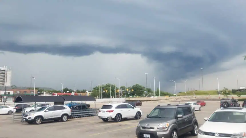

🌪️ Strong thunderstorms expected Sunday afternoon and evening
Kansas City is bracing for one final round of active weather in what has been a stormy pattern lately. According to Jeff Penner in the KSHB 41 Weather Blog, the next system is expected to arrive Sunday afternoon into the evening, potentially bringing severe weather to parts of the area.
💥 Risk level: 2 out of 5
The northwest edge of the risk zone includes eastern Kansas and portions of northwest Missouri, which fall under a level 2 out of 5 severe weather threat according to the NOAA Storm Prediction Center. The highest risk, at a level 4 out of 5, is forecast along the Red River, which separates Oklahoma and Texas.
🌧️ What to expect
Sunday’s storms may include:
Damaging wind gusts that could exceed 60 mph
Medium-sized hail, potentially hazardous to vehicles and crops
Isolated tornadoes, particularly in areas south and southeast of Kansas
🌡️ Stark temperature contrasts
The setup includes a strong clash between hot, humid air surging from the south and cooler, more stable air to the north, fueling instability across the region. Afternoon highs in the threat zone are forecast to reach near 90°F (32°C), with even higher heat index values.
📡 Stay alert
Conditions are expected to evolve quickly, with storms developing as early as mid-afternoon, peaking in intensity between 4 PM and 9 PM local time.
Jeff Penner urges viewers to watch the full four-and-a-half minute video update posted in the blog for localized insights and to stay alert for any warnings issued by the National Weather Service.
Enjoy the rest of your weekend and stay safe.


