
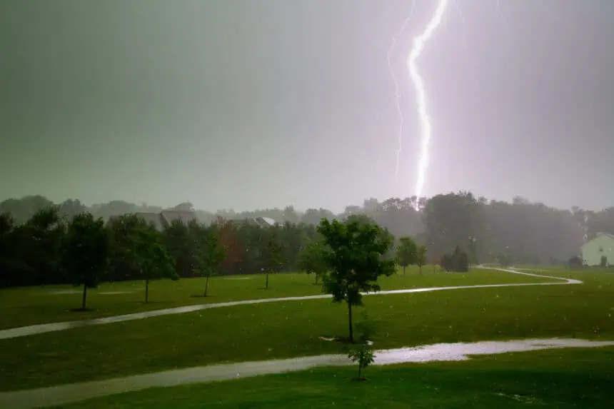

Slow-moving showers continue to drench central Indiana
Saturday, June 14, 2025 — INDIANAPOLIS, Indiana — Persistent rain showers and scattered storms are once again making their presence known across central and northern Indiana, especially along and north of the I-70 corridor this morning. These slow-moving systems are gradually shifting southward through the afternoon, setting the stage for yet another wet and unpredictable day.
Localized flooding risk remains high
Rain totals are highly variable, depending on whether you’re caught under a persistent downpour or spared altogether. Localized areas may accumulate over 2 inches (50+ mm) of rain, while other zones may receive less than 0.25 inches (6 mm). The flooding risk remains elevated, especially in urban zones and low-lying areas near Indianapolis, Muncie, and Richmond.
Potential cold air funnels: weak but notable
A rare weather phenomenon may also emerge: cold air funnels. While these are typically short-lived and weak, they’re still worth mentioning due to their rotational characteristics, though they rarely make ground contact.
Temperature outlook for Saturday
High temperatures will hover near 80°F (27°C) this afternoon, under cloudy to mostly cloudy skies with intermittent breaks. The combination of humidity and instability will fuel additional storm development, especially during the early afternoon hours.
Tonight: lingering clouds but drier skies
As Saturday evening progresses, most of the precipitation will exit the region. However, cloud cover will remain entrenched, helping to trap warmth. Expect overnight lows to dip only into the mid to upper 60s°F (18–20°C).
Sunday’s Father’s Day outlook
Father’s Day on Sunday will bring a mix of clouds and sun, with only isolated showers or storms expected during the afternoon and evening, and mainly south of I-70. Most areas — including Bloomington, Columbus, and Seymour — should stay dry, making for a more pleasant afternoon. Highs will reach the low 80s°F (27–28°C).
Extended forecast: humidity stays, storms return midweek
Looking ahead to next week, humidity levels remain high, with temperatures staying in the 80s°F (26–29°C). Expect a daily chance for isolated pop-up storms during the afternoon and early evening hours. A more organized system may arrive late Wednesday into Thursday, bringing a greater chance for widespread rain across central Indiana, including Indianapolis, Lafayette, and Terre Haute.


