

Strong thunderstorms over Eastern North Carolina Sunday night
An urgent weather alert was issued by the National Weather Service (NWS) in Wakefield, Virginia, on Sunday, June 15, at 8:13 p.m., forecasting strong thunderstorms across Eastern North Carolina through 9 p.m. The affected areas include Northampton, Hertford, Gates, and Bertie counties.
According to the NWS, wind gusts could reach up to 40 mph (64 km/h). These fast-moving storms were observed moving northeast at 25 mph (40 km/h), with the radar tracking a line of thunderstorms extending from Boykins to just south of Lewiston Woodville, passing near Ahoskie.
Hazards expected
Residents in the alert zones should expect frequent lightning strikes, reduced visibility, minor flooding, and the possibility of tree limbs falling due to gusty winds. The NWS warns that unsecured outdoor items may be blown around, and driving conditions may become hazardous.
Towns impacted and expected timing
Thunderstorm activity was projected in the following locations at these approximate times:
8:20 p.m.: Ahoskie, Murfreesboro, Aulander, Newsoms, Como
8:25 p.m.: Winton, Cofield
8:30 p.m.: Courtland, Powellsville
8:35 p.m.: Suffolk
8:40 p.m.: Franklin, Hunterdale
8:45 p.m.: Roduco
Other areas that may experience storm activity include Goose Pond, Whites Crossroads, Tunis, Earleys, Menola, Newsome Store, Chowan Beach, Topsy, Republican, and Burden.
The NWS strongly advises seeking shelter indoors, especially for individuals currently outdoors or in open areas.
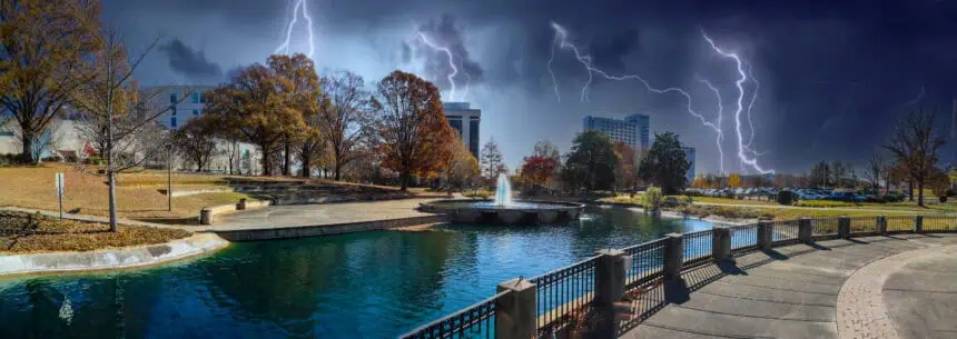
Understanding lightning hazards and how to stay safe
In the United States, approximately 25 million lightning strikes are recorded annually, with the majority occurring during the summer months. Lightning poses serious danger and causes around 20 deaths each year.
The threat increases as the storm nears, peaking when directly overhead, then decreasing once it passes. However, lightning can still strike before or after the main storm cell has moved.
Essential safety precautions during thunderstorms
If you’re outdoors, it is crucial to have a plan to reach a sheltered area quickly. Once indoors:
Avoid contact with:
- Corded phones
- Electrical devices
- Water sources (like sinks or tubs)
- Windows and doors
Wait at least 30 minutes after the last thunderclap before going back outside.
If sheltering indoors isn’t possible:
Stay away from hilltops, open fields, and ridgelines. Isolated tall trees are especially dangerous. In wooded areas, position yourself among lower tree growth. When in groups, maintain space between individuals to reduce risk of electrical current transfer.
Avoid metal and water, as both are excellent conductors even though they don’t attract lightning.
During camping, choose a low-lying location like a valley or ravine. Remember, tents offer no lightning protection.
Driving during storms: hazards and tips
When on the road during heavy rain, visibility drops, and the risk of hydroplaning increases. Here’s how to manage it:
Turn on headlights, even during daylight, to enhance visibility and signal your presence to other drivers.
Prefer center lanes on the highway and elevated roads, since water accumulates near edges. Avoid puddles, which can cause hydroplaning and sudden loss of control.
Stay clear of large vehicles such as trucks and buses, which create spray that can impair your vision.
Never drive into flooded areas. Flash floods can pull vehicles off the road. Deep water can cause engine damage or electric system failure.
What is hydroplaning and how to react
Hydroplaning occurs when tires lose traction and slide on a thin film of water instead of gripping the road.
Key factors:
- Speed: Faster driving = lower tire grip
- Water depth: Even a thin layer can trigger it
- Tire tread: Worn-out treads make hydroplaning more likely
If you begin to hydroplane:
Ease off the gas, don’t brake hard.
Steer into the skid to realign the tires.
Wait until you feel the vehicle regain contact with the road.
If needed, brake lightly — use normal braking if you have ABS, or pump gently in older models.


