

- Severe weather batters Denver and Eastern Plains on Tuesday
- Denver International Airport paralyzed by delays and ground stops
- Tennis and baseball-sized hail smashes parts of Milliken
- Storm watch covers over 5 million residents along Front Range
- Severe early morning weather brings hail and winds near I-70
- Air travel turbulence began well before sunrise
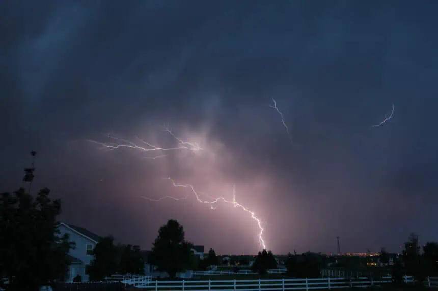
Severe weather batters Denver and Eastern Plains on Tuesday
Tuesday, June 17, marked an extraordinary day of severe weather across Metro Denver and the Eastern Plains, with intense thunderstorms, hail as large as baseballs, and major air travel disruptions. The Pinpoint Weather Alert Day lived up to its warning, unleashing a rare overnight storm system that caused widespread delays and damage.
Denver International Airport paralyzed by delays and ground stops
By early afternoon, the Federal Aviation Administration declared a ground stop at Denver International Airport (DIA) due to persistent thunderstorms. All departures to DIA were halted until 3 p.m., and a ground delay remained in place through 9 p.m., causing average delays of 30 minutes. As of 2 p.m., an astonishing 836 flights were delayed, with four flights canceled, according to FlightAware. Travelers heading to or from DIA were advised to check real-time updates due to the unpredictable conditions.
The stormy weather proved especially punishing for Southwest Airlines, which saw over 335 delays, followed by United with 113, SkyWest with 66, and Delta with 21.
Tennis and baseball-sized hail smashes parts of Milliken
In Milliken, to the north of Denver, hailstones reached the size of baseballs, measuring up to 2.75 inches in diameter. FOX31’s Carly Moore captured the extensive damage to vehicles in the area, where numerous residents reported cracked windshields, dented roofs, and smashed windows. The situation escalated quickly as tennis ball-sized hail also pounded surrounding neighborhoods.
Storm watch covers over 5 million residents along Front Range
A severe thunderstorm watch from the National Weather Service remained in effect until 5 p.m. Tuesday, covering the entire Front Range and much of the Eastern Plains. This vast zone, home to more than 5 million people, faced threats of large hail up to apple-size, tornado potential, and destructive wind gusts.
Severe early morning weather brings hail and winds near I-70
In the early morning hours, communities such as Elizabeth, Deer Trail, and sections along Interstate 70 were hit with penny-sized hail and gusts up to 40 mph. The NWS issued special alerts warning residents to shelter in sturdy structures. Simultaneously, locations north and east of Denver — including Wellington, Johnstown, Eaton, Barr Lake, and Milliken — recorded hailstones between 1.5 and 2.5 inches in diameter.
Air travel turbulence began well before sunrise
By 6:20 a.m., the weather had already grounded or delayed over 347 flights at DIA, with the majority — 322 flights — affecting Southwest Airlines. Conditions remained difficult throughout the day, as thunderstorms returned repeatedly, making Tuesday one of the most disruptive weather days for the Denver metro in recent memory.


