

July begins with a cooler twist for parts of coastal California, offering a notable contrast to the widespread summer heat expected across the rest of the United States. After July 2024 shattered records as the hottest month ever for the Golden State, early indicators suggest July 2025 may spare the coastlines—at least temporarily—from extreme heat.
A different start for California this July
According to the Climate Prediction Center, most of the country is bracing for above-average temperatures in July, but a pocket of relief is expected along the California coast, including San Francisco, Santa Cruz, and areas around the Bay Area. The latest outlook shows these zones facing equal chances of warmer or cooler-than-normal conditions, a stark deviation from the intense inland heat.
This cooling pattern is rooted in sea surface temperatures, which are currently running 1 to 3 degrees Fahrenheit (0.5 to 1.5°C) below average just off the California coast. This anomaly is linked to vigorous upwelling from persistent Pacific storm systems, reinforcing the marine layer and suppressing daytime highs near the shore.
Temporary relief before the ridge builds
The cool marine influence, however, is unlikely to last beyond mid-month. By the second week of July, weather models project a strengthening ridge of high pressure over the interior West. This feature typically dominates summer weather patterns, forcing heat to spread northward and westward into Northern California and even threatening to erode the marine layer.
By mid-July, interior valleys, including parts of the Bay Area, may begin seeing temperatures soar into the 90s to over 100°F (32 to 38°C). The San Francisco Peninsula and coastal sections may stay cooler a bit longer, but that window is expected to shrink as the ridge amplifies.
Heightened fire risk looms by late July
The transition to a hotter, drier pattern could raise the fire weather threat across California, particularly toward the end of the month. As vegetation dries under persistent sun and heat, even coastal zones may face elevated risk. Any diminishing marine influence could leave large swaths of the state vulnerable.
Additionally, early signs of an active Southwest monsoon are appearing. While beneficial in terms of moisture, this pattern can also bring dry lightning, especially to mountainous regions, triggering wildfires under parched conditions.
Tuesday July 1 outlook: Cool coast, hot inland
San Francisco
A deep marine layer dominates the city early Tuesday, cloaking downtown, Outer Sunset, and Richmond in low clouds. While eastern neighborhoods like Potrero Hill, SoMa, and the Mission may catch some afternoon sun, much of the city will stay gray and breezy. Highs will top out in the mid to upper 60s°F (18–20°C) downtown, hover around 60°F (16°C) in the west, and remain in the upper 50s°F (14–15°C) along the immediate coast. Overnight, low clouds and patchy drizzle return with lows in the low to mid-50s°F (10–12°C).
North Bay
Gray skies stretch across Petaluma, Santa Rosa, and into Vallejo by sunrise. But by late morning, sunshine breaks through east of the Carquinez Strait, especially around Napa and Novato. Fairfield and Vacaville begin the day clear and sunny. Afternoon temperatures reach the low to mid-80s°F (27–29°C) in Santa Rosa and nearby valleys, with upper 70s°F (25–26°C) in Petaluma, San Rafael, and Novato. Winds pick up gently from the southwest. Another push of marine clouds is expected after midnight along Highway 101, with overnight lows in the low to mid-50s°F (10–12°C).
East Bay
Clouds stretch from the Berkeley shoreline through the Tri-Valley, with places like Walnut Creek and Pleasanton clearing by late morning. Meanwhile, Oakland and Richmond hold onto clouds a bit longer. Highs will vary from the low 70s°F (21–22°C) in Oakland, upper 70s to near 80°F (25–27°C) in Fremont and Hayward, to mid-80s to near 90°F (29–32°C) in inland valleys. Evening clouds return, especially around the Bay shoreline, with lows in the mid- to upper 50s°F (13–15°C).
Pacific Coast and Peninsula
Tuesday morning will bring persistent low clouds across Daly City, Pacifica, and Half Moon Bay, with little clearing expected through the day. Temperatures here will stay locked in the low 60s°F (16–17°C). On the Peninsula, morning clouds give way to afternoon sun in South San Francisco and San Mateo, reaching highs in the upper 60s to mid-70s°F (20–24°C). Redwood City and southern Peninsula cities will hit the low 80s°F (27°C). Winds remain light out of the northwest, and evening fog returns, with lows in the 50s°F (10–15°C).
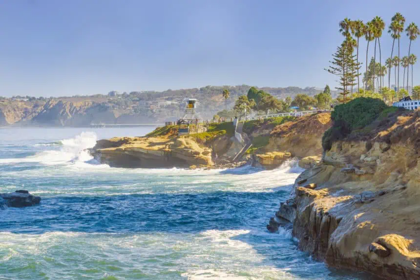
South Bay and Santa Cruz
Patchy cloud cover starts the day across Santa Cruz and the South Bay, but skies will clear rapidly inland. San Jose, Cupertino, and the Santa Clara Valley enjoy sunny skies by midmorning. Santa Cruz clears later but sees ample afternoon sunshine. Highs range from the low 80s°F (27°C) in San Jose, mid- to upper 80s°F (29–31°C) in Cupertino and South San Jose, to the mid-70s°F (23–24°C) along the coast. Light northwest breezes continue into the night with patchy clouds and overnight lows in the 50s°F (10–15°C).


