

Monday, July 7, 2025 – New York, 9:32 a.m. EDT
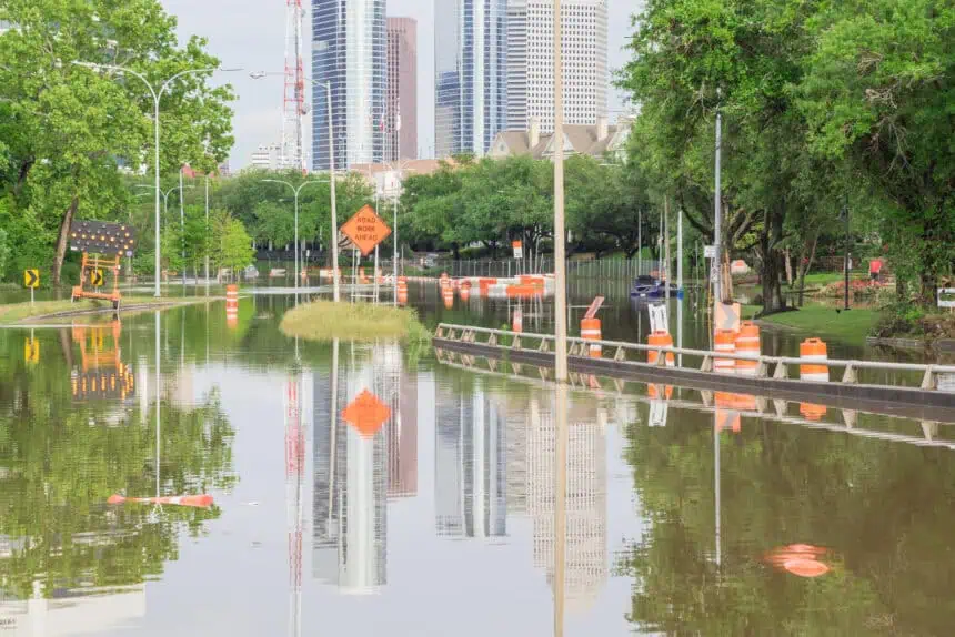
Kerr County, Texas – The devastating flash flood that tore through the Guadalupe River on the night of July 4 left a trail of destruction across the Texas Hill Country, with homes swept away, vehicles overturned, and dozens of lives lost, including at least 15 children.
The rainfall—equivalent to four months—fell in just a few hours, creating a sudden wall of water in the dead of night. The timing severely limited how many people received emergency alerts and were able to move to higher ground.
The National Weather Service (NWS) issued multiple warnings about potentially life-threatening flooding, starting hours in advance. But questions remain: Who actually received the alerts? Did staff shortages at key weather offices delay communications? And has alert fatigue taken hold in a region considered one of the most flood-prone areas in the entire country?
National Weather Service defends its warnings
The NWS began issuing alerts as early as Thursday morning, July 3, warning of dangerous flood potential in Kerr County. A flood watch was issued at 1:18 p.m. CT, including Kerrville among the areas at risk. However, officials have pointed out that forecast rainfall totals underestimated the event: predictions ranged between 5 to 7 inches (127–177 mm), but parts of Central Texas received over 15 inches (381 mm).
The most critical warning—highlighting potentially deadly flash flooding—came at 1:14 a.m. on July 4, activating the Emergency Alert System (EAS). Cell phones in the affected areas should have received the alarm, assuming signal coverage and that users hadn’t disabled weather alerts.
Around 5:00 a.m., the Guadalupe River breached its banks, sweeping away homes, cabins, RVs, and cars. The 20-foot (6-meter) flood surge took just over 90 minutes to push downstream—marking the second-highest crest ever recorded in the river’s history.
Missing staff and limited tools
The NWS offices in Austin-San Antonio and San Angelo, the most involved in issuing warnings, are both operating without key staff—including a warning coordination meteorologist in Austin-San Antonio, a crucial liaison between forecasters and emergency managers.
Tom Fahy, legislative director of the NWS employee union, said the office still had “adequate staffing and resources,” but acknowledged the absence of this critical role. According to a NOAA official, these vacancies stem from early retirement incentives enacted under the Trump administration to reduce the size of the federal workforce.
Beyond Texas, several NWS offices nationwide are struggling with even worse staffing shortages, with some no longer operating 24/7. In many locations, the routine launch of weather balloons—a vital tool for tracking storms—has been suspended due to lack of personnel.
Still, a NOAA official stood by the agency’s response, pointing out that the catastrophe stemmed from an unprecedented amount of rainfall in a very short timeframe, during the least opportune time to reach residents: the overnight hours.
In Texas Hill Country, where summer thunderstorms frequently trigger flash floods, the public has grown weary of constant alerts—a phenomenon meteorologists call alert fatigue.
Outdated forecasting tech faces political headwinds
The tragedy has exposed gaps in current forecasting technology. Meteorologists still cannot reliably predict when a cluster of slow-moving thunderstorms will stall over one location, producing catastrophic rainfall totals.
Ironically, as the need for improved tools grows, the 2026 federal budget proposed by President Donald Trump’s administration would eliminate NOAA’s entire research division, including all federally funded climate and weather laboratories and university-partnered institutes.
Among the labs slated for closure is the National Severe Storms Laboratory in Norman, Oklahoma, which is actively working to improve flash flood forecasting models.
These cuts would stall the development of next-generation forecasting tools, computer models, and early warning systems, just as climate change is producing more frequent and intense rainfall across the United States.
Officials defend their response
NOAA spokesperson Kim Doster told CNN that the National Weather Service provided sufficient advance notice, noting that the Austin/San Antonio office began briefing emergency managers on the morning of July 3 and issued a flood watch that afternoon.
Flash flood warnings were issued during the evening of July 3 and into the early hours of July 4, offering a lead time of more than three hours before floodwaters overtook the area.
At a Saturday press conference, Texas Governor Greg Abbott praised both federal and local officials, describing the response as swift in the face of a once-in-a-century event.
“Kerr County Judge Rob Kelly” said there was no indication that the storm would escalate to such deadly levels: “We have floods all the time,” he stated Friday. “But we had no reason to believe it would be anything like this. None whatsoever.”
The Kerrville city manager echoed the sentiment, saying the event unfolded so fast that they couldn’t anticipate the severity, even with the alerts.
As the search continues for more than 20 missing girls—swept away from a summer camp during the storm—local leaders are insisting there was nothing more they could have done.
Rep. Chip Roy, speaking from Texas, said public scrutiny was expected: “People are going to ask why and how. I understand that. Parents, the media—everyone wants answers.”
At the same press conference, Homeland Security Secretary Kristi Noem defended the federal government and the National Weather Service, while emphasizing the need to modernize outdated systems.
“The NWS, together with NOAA, has said for years that we need to overhaul this aging infrastructure, and that’s what we’re working on,” Noem said.
A NOAA official told CNN they were unsure what specific reforms Noem was referencing, but confirmed that network, radar, and modeling system upgrades are already underway—some of which began prior to Trump’s return to office.


