

New York is under weather alert due to a dangerous combination of extreme heat and intense storms, which could bring life-threatening conditions in the coming days. As of this Wednesday morning, temperatures are already near 95°F (35°C), and forecasts indicate that the situation may become more hazardous through the rest of the week.
Heat warnings in effect as temperatures surge
The National Weather Service has issued heat advisories for New York City and surrounding areas, warning that the heat index—the temperature felt by the body due to humidity—could exceed 103°F (39.5°C) for several consecutive days. This prolonged exposure to sweltering heat raises serious concerns for public health and urban infrastructure.
At the heart of this intense heat lies a heat dome: a high-pressure system that traps hot, moist air over a region, effectively blocking cooler air from moving in. Meteorologists expect this pattern to remain anchored over the Northeast through Thursday, extending the risk of heat-related illnesses and energy strain.
Flash flood watch issued ahead of severe storms
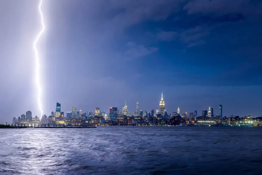
The oppressive heat is only one part of the threat. A cold front approaching from the west is expected to collide with the humid air mass by Tuesday evening, triggering severe thunderstorms, damaging wind gusts over 55 mph (90 km/h), and torrential rain.
These storms could drop up to 2 inches (5 cm) of rain per hour in localized areas, significantly increasing the chance of flash flooding. A flood watch has already been activated in the Hudson Valley, where saturated ground from previous rainfall may exacerbate the flooding risk.
Mayor Adams warns of dangerous heat ahead
Mayor Eric Adams has stressed the seriousness of the incoming weather, urging residents of New York City to stay hydrated, avoid outdoor activities during peak heat hours, and use air conditioning whenever possible. Vulnerable populations, such as the elderly, children, and those with chronic illnesses, are at particular risk—especially individuals without access to cooling centers or shaded public areas.
To mitigate the impact, the city has opened cooling centers and set up hydration stations in high-risk neighborhoods. Municipal crews are also working to clear storm drains in preparation for potential flooding during and after the storm system’s passage.
Heat-related deaths rising nationwide
Public health officials note that heat waves, increasingly frequent due to climate change, have become the deadliest weather-related hazard in the United States. In 2023 alone, more than 2,300 deaths were attributed to excessive heat, surpassing fatalities from hurricanes, floods, and tornadoes combined.
Research also shows that heat domes are becoming stronger and more persistent, raising alarms about the need for long-term urban adaptation and climate resilience strategies.
Brief relief possible by the weekend
Looking ahead, the most critical period appears to be Tuesday through Wednesday, with a possible drop in temperature by Friday, although scattered showers may linger into the weekend. Forecasts for Saturday and Sunday suggest partly cloudy skies with moderate highs, offering some temporary relief for New Yorkers bracing for one of the most intense weather patterns of the summer.


