

OMAHA, Nebraska (WOWT) — As of 9:30 PM, the Tornado Watch in effect for northeastern Nebraska has been allowed to expire at 10:00 PM, marking a notable shift in the region’s severe weather outlook.
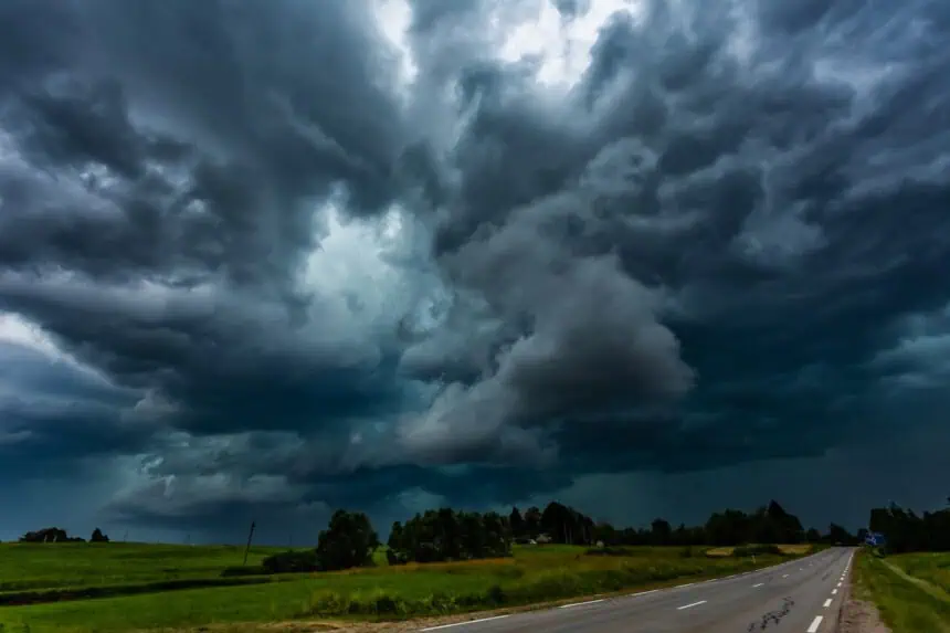
What was shaping up to be a volatile evening of thunderstorms has turned out to be far less intense than originally feared. So far, the storms that have moved through eastern Nebraska and western Iowa have failed to produce widespread damaging winds or large hail. While more storms are still expected overnight, the risk of severe weather — especially tornadoes — has significantly decreased.
That said, forecasters aren’t ruling out an isolated stronger storm between now and 1:00 AM, particularly across northeast Nebraska, where conditions could still support wind gusts over 60 mph and hail up to 1 inch in diameter. But at this point, such storms are likely to be few and far between.
Earlier in the evening, around 8:00 PM, a Severe Thunderstorm Watch was issued for a wider area across eastern Nebraska and western Iowa, replacing parts of the earlier Tornado Watch. While the threat for tornadoes now appears confined to far northeast Nebraska, the main concern for most of the region is strong, damaging winds and pockets of hail.
Thursday was declared a First Alert 6 Weather Day, with forecasters tracking a renewed threat for storms late in the day. Thunderstorms began developing around 7:00 PM in the northwest corner of the state, where conditions briefly supported the potential for tornadoes and large hail. As those storms moved southeast, the threat shifted to more straight-line wind damage, with gusts that could reach up to 70 mph.
A Flood Watch remains in effect for areas near and north of Interstate 80, where the heaviest rainfall is expected to fall overnight. This advisory extends into Friday morning, with a few rounds of heavy rain possible before things dry out.
In the Omaha Metro, storms are expected to peak between 9:00 PM and midnight, gradually pushing southeast and weakening overnight. A few scattered showers or thunderstorms may still linger into early Friday morning.
Looking ahead, forecasters are keeping an eye on another potential round of severe weather Friday evening, especially southeast of the Metro, where another threat for damaging winds and hail may develop. After that, the weekend looks quieter, offering a brief break from the recent string of stormy days.


