

Strong thunderstorms swept through Greater Rutherford and Eastern Polk on Tuesday evening, prompting an updated weather alert from the National Weather Service Greenville-Spartanburg SC at 7:37 p.m., effective until 8:15 p.m. EDT.
Thunderstorm impacts in Greater Rutherford and Eastern Polk
At the time of the alert, Doppler radar identified a stationary storm system approximately 8 miles south of Rutherfordton. This storm was producing marble-sized hail—approximately 0.5 inches in diameter—and wind gusts reaching up to 40 mph.
According to the NWS, strong winds could cause tree limbs to fall and unsecured items to be blown around. The hail may also result in minor damage to outdoor property.
Areas expected to be most affected include Forest City, Rutherfordton, Columbus, Spindale, Landrum, Chesnee, Mill Spring, Henrietta, Harris, and Lake Adger.
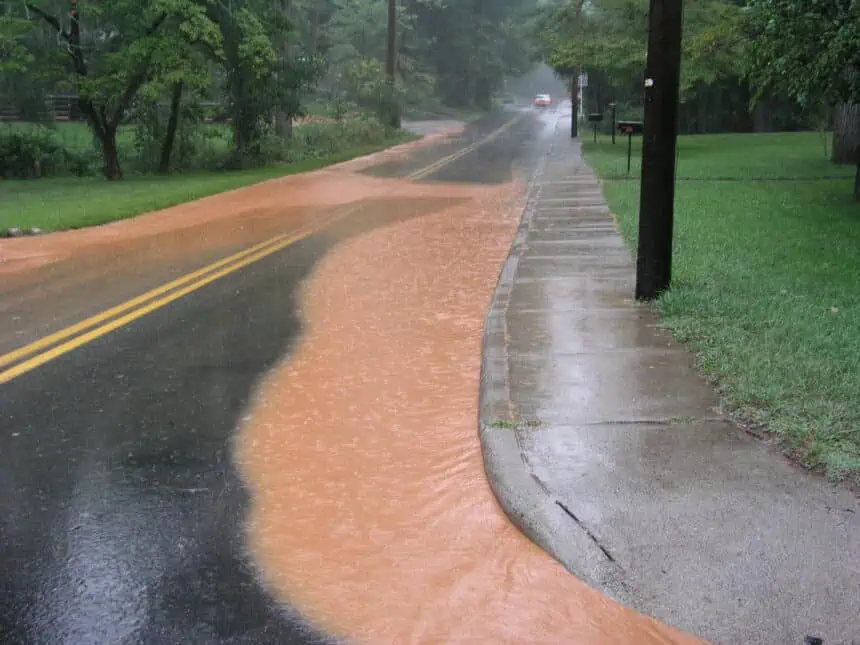
Flooding concerns due to torrential rainfall
The NWS warned of torrential downpours, capable of leading to localized flooding. “Do not drive through flooded roadways,” the alert emphasized, as even shallow waters can carry away vehicles or hide road hazards.
Understanding the lightning threat
Lightning strikes the United States about 25 million times a year, particularly during the summer months. On average, 20 fatalities occur each year due to lightning. The risk of a lightning strike increases as a storm approaches and peaks when it is overhead.
When thunder is audible, it signals that lightning is close enough to pose a danger. The NWS advises waiting at least 30 minutes after the last thunder before going back outside.
If shelter is not available outdoors
Avoid elevated areas such as hilltops or ridges, and stay away from tall, isolated trees. In forested areas, remain in lower sections with denser tree coverage. In open settings, choose low-lying areas like valleys or ravines—tents offer no protection against lightning.
Avoid touching metal, water, or wet surfaces, as these materials conduct electricity extremely well, even though they do not attract lightning.
Driving in heavy rain: safety considerations
Visibility and control are compromised during intense rainfall. Headlights should be on even in daylight. Stick to middle lanes and elevated sections of the road, since water accumulates more heavily at the edges.
Avoid large puddles that could cause hydroplaning, and maintain a safe distance behind large vehicles, which can reduce your visibility with heavy spray. Never attempt to drive through flooded roads—the water may be deeper than it appears, and flash floods are often fast-moving and dangerous.
What is hydroplaning?
Hydroplaning occurs when a vehicle slides uncontrollably on a wet surface. It happens when water pressure builds under the tires faster than the car’s weight can disperse it. This lifts the tires, creating a thin layer of water between the tires and the road, eliminating traction.
The likelihood of hydroplaning is highest when vehicle speed is high, water is deep, or tire tread is worn. To reduce risk, drive slower, ensure your tire treads are adequate, and avoid deep water.
If your vehicle begins to hydroplane, ease off the gas, turn gently into the skid, and wait for the tires to reconnect with the road surface. Brake lightly if necessary—use standard braking with anti-lock systems, or gently pump brakes in older vehicles without ABS.


