

Tuesday, July 15 is bringing another hot and humid summer day across Nebraska, but the evening hours carry an increasingly dangerous weather risk, especially across central Nebraska.
This morning, temperatures began in the upper 60s to low 70s°F (around 20–22°C), but will quickly climb back into the low to mid 90s°F (32–35°C) by this afternoon, especially along and south of I-80. The added humidity will push the heat index even higher, making it feel oppressively muggy in many locations.
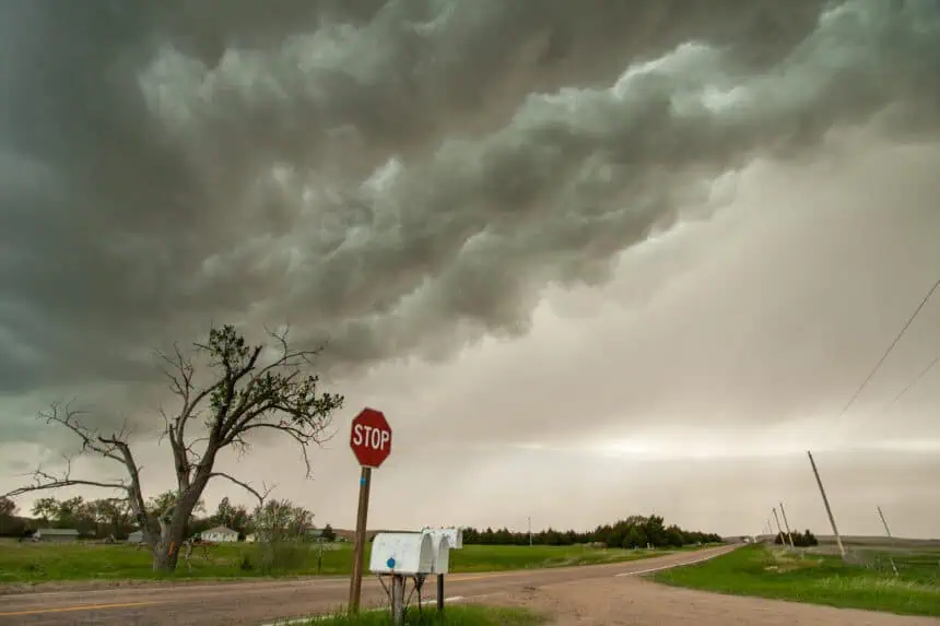
Severe storm outlook upgraded
The Storm Prediction Center has now raised the severe weather risk for central Nebraska to an Enhanced risk (Level 3 of 5). The main concern is for damaging wind gusts, especially late this afternoon into the evening. Areas including and surrounding Kearney, Grand Island, and Broken Bow face the highest threat. Winds could exceed 75 mph (around 120 km/h), with black hash marks on the latest maps indicating the potential for destructive straight-line winds.
Farther southeast, including Lincoln, the risk level is Slight (Level 2 of 5). However, by the time storms approach southeast Nebraska later Tuesday night, they are expected to weaken significantly.
Isolated tornado and hail threat
Alongside the wind hazard, there’s a limited tornado risk across northern Nebraska. As storms interact with a cold front, conditions could support a brief, spin-up tornado, especially between Valentine and O’Neill in the late afternoon to early evening hours.
The potential for hail is also present, particularly during the early stages of storm development over North Platte and into north-central Nebraska. As storms mature, the wind threat will dominate.
Timing the storms
According to the latest Stormcast models, storms are expected to initiate in northwest Nebraska by late afternoon, then move southeastward through central Nebraska during the evening hours. A pronounced gust front is forecast to surge ahead of the storms by Tuesday night, indicating a weakening trend as the system pushes into southeast Nebraska.
After midnight, storm coverage will become scattered and less organized, especially between 12 a.m. and 2 a.m. Wednesday.
Rainfall outlook and temperature shift
Rain totals in southeast Nebraska will be limited due to the diminishing storm strength overnight, but central and northern parts of the state are likely to receive more measurable precipitation.
More rounds of rain are possible later this week, especially by Thursday, when temperatures will drop noticeably, with highs falling into the 70s°F (21–26°C).


