
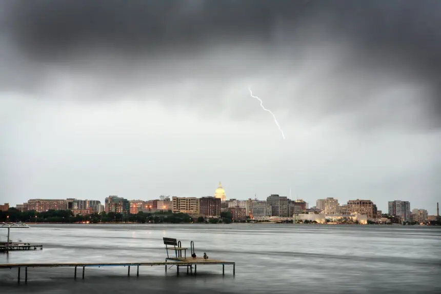

**Heat and humidity continue to build across much of southern and central Wisconsin this Wednesday, July 16, with a First Alert Day in effect due to the high likelihood of strong to severe thunderstorms later in the day. The heat index will climb into the lower 90s°F (32–34°C), driven by a thick, moisture-laden air mass that’s setting the stage for volatile afternoon and evening conditions.
Warm, unstable air mass ignites storm development Wednesday
Throughout the day, the combination of soaring temperatures and oppressive humidity will energize the atmosphere, especially between 2:00 PM and 8:00 PM local time, when the greatest risk of severe weather is expected. Forecast models indicate that damaging wind gusts, hail, and torrential downpours may accompany the stronger storm cells, particularly across areas including Madison, La Crosse, and parts of central Wisconsin. The Storm Prediction Center has issued a Level 2 out of 5 “Slight Risk” across the region, underscoring the potential for organized, fast-moving storms capable of producing localized flooding.
Cooler, drier air arrives Thursday into Friday
A cold front will advance across Wisconsin late Wednesday night into Thursday, bringing a decisive end to the heat and humidity. In its wake, temperatures will drop into the mid to upper 70s°F (24–26°C) by day, with overnight lows cooling into the upper 50s to near 60°F (14–16°C). The transition will usher in a pleasant and refreshing air mass, supported by high pressure dominating the area through Friday.
Weekend outlook: unsettled with increasing rain chances
By Saturday, the weather pattern becomes more variable again. A weak surface trough sliding through the Upper Midwest will increase the probability of showers and thunderstorms, with current forecasts showing a 30% to 50% chance of rain throughout Saturday, possibly extending into Sunday night. Temperatures will rebound gradually, and humidity will begin to rise, hinting at a return to more active conditions by early next week across Wisconsin.


