

- Tonight: Risk of flash floods from mountains to deserts
- Thursday: Morning showers in the Valley, clearing by afternoon
- Outlook: Slight cooldown, then hotter weekend ahead
- Heat safety remains critical as temps rebound
- Vehicle precautions during extreme heat
- Rain and flood safety: Don’t take risks
- Thunderstorm readiness: Know your safe zone
- Monsoon preparedness across the Valley
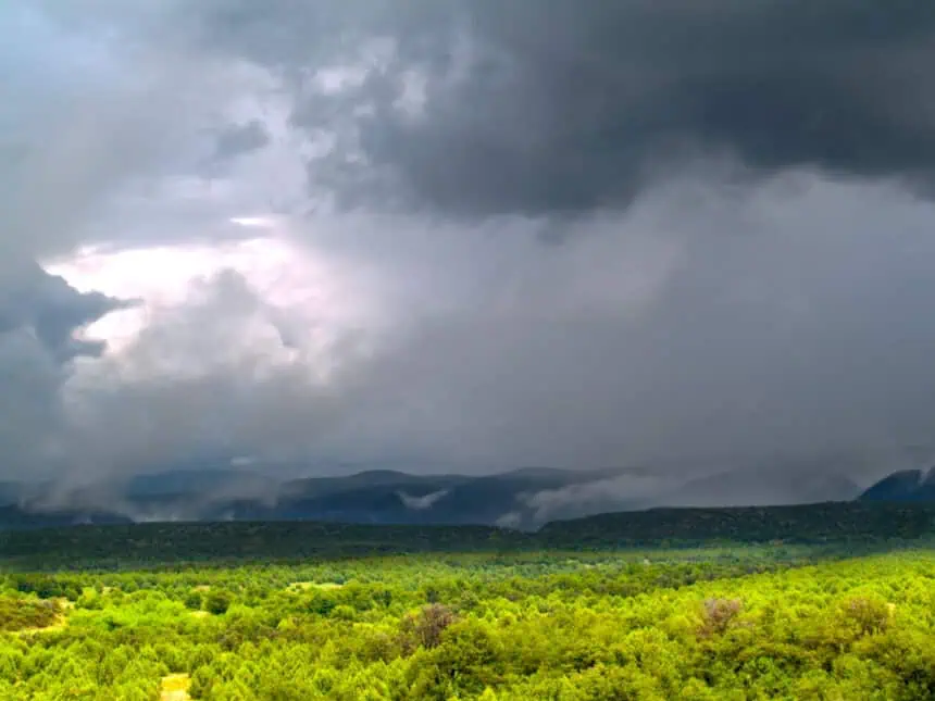
Scattered thunderstorms sweep across northern Arizona
PHOENIX, Arizona – On Wednesday, July 16, monsoon storms unloaded heavy rainfall across much of northern Arizona, especially over the mountain regions, bringing both relief from the heat and risks of flooding. Phoenix recorded a high of 97°F (36°C), with thunderstorms keeping skies mostly cloudy by late afternoon.
Flash flood alerts were activated in critical areas including the Grand Canyon and near Page, as intense downpours triggered localized flooding. These conditions are expected to continue through the night across several parts of the state.
Tonight: Risk of flash floods from mountains to deserts
Widespread heavy rain is forecast to persist in the high terrain of northern and eastern Arizona until approximately midnight. After that, rain chances increase for the desert areas, including Phoenix and the surrounding Valley.
Flash flood warnings remain in effect, particularly for canyon zones and low-lying regions. Roads near Flagstaff, Sedona, and Winslow may be impacted by water accumulation, with desert storms becoming more active after midnight.
Thursday: Morning showers in the Valley, clearing by afternoon
Thursday morning will begin with scattered downpours across the Phoenix metro and surrounding suburbs. Rain may be moderate to heavy during the early morning commute, reducing visibility and road traction. However, by 7:00 a.m., activity will begin to taper off, becoming more isolated.
As the day progresses, sunny intervals will return to the Valley, though a few pop-up showers remain possible. Meanwhile, storms will shift northward into the high country, where activity is expected to persist into the evening, before dissipating overnight.
Outlook: Slight cooldown, then hotter weekend ahead
Even with monsoon moisture in the mix, temperatures will remain below average for mid-July. Overnight lows tonight will dip into the low 80s°F (27–28°C). On Thursday, the Valley will warm to near 100°F (38°C).
By the weekend, conditions will dry out, and temperatures will climb again, reaching around 107°F (42°C) by Saturday and Sunday under mostly sunny skies across Arizona.
Heat safety remains critical as temps rebound
Despite the temporary relief from the monsoon storms, the Arizona Department of Health Services continues to emphasize heat illness prevention. Residents are urged to stay indoors during peak heat hours, drink water regularly, and avoid prolonged exposure to the sun. Those particularly vulnerable — including the elderly and young children — should be checked on frequently.
Vehicle precautions during extreme heat
The Arizona Department of Transportation (ADOT) reminds drivers to be vigilant when traveling during hot weather. Keep your gas tank at least three-quarters full, and carry extra water in a cooler with frozen bottles for emergency use. If your AC fails or your car breaks down, exit safely, seek shade away from the roadway, and avoid walking barefoot or letting pets’ paws touch the pavement.
Vehicle maintenance is key: check your tires, coolant, and battery before any long trip. Hot pavement and low tire pressure are a dangerous mix that can lead to blowouts. Make sure your AC system is functioning properly and all engine fluids are topped off.
Rain and flood safety: Don’t take risks
During this active monsoon season, the American Red Cross warns: “Turn around, don’t drown.” If you encounter a flooded road, do not attempt to cross it. If you’re caught in a rising water situation, exit your vehicle immediately and move to higher ground. Follow local news, NOAA radio, and official evacuation orders without delay.
Thunderstorm readiness: Know your safe zone
With storms capable of producing dangerous winds, hail, and flash floods, prepare your household with an emergency kit, a battery-powered radio, and a disaster plan. Find a secure area in your home away from windows and glass doors, where everyone can shelter during severe thunderstorms.
Monsoon preparedness across the Valley
According to Captain Ashley Losch from the Glendale Fire Department, desert storms can cause power outages, service disruptions, and dangerous floodwaters in a matter of minutes. Residents are urged to store flashlights with extra batteries, maintain a first aid kit, and keep non-perishable food and clean water (at least one gallon per person) on hand.
In the event of a medical emergency, ensure backup power is available for devices, and keep phone chargers that don’t rely on outlets. Pets should remain indoors during storms. Never attempt to drive into flowing water, even if it appears shallow—it takes less than 10 inches to sweep a vehicle away.
Be cautious around downed power lines, which can energize the ground within a 200-foot radius. If rising waters threaten your location, evacuate to higher ground immediately.
Stay weather-aware across Arizona as this monsoon system continues to bring unpredictable, intense storms throughout the region.


