

Cyclone chances drop as disorganized Gulf system inches toward Louisiana
NEW ORLEANS, Louisiana — The system known as Invest 93L, currently lingering over the northern Gulf of Mexico, is showing fewer signs of strengthening into Tropical Storm Dexter, according to the National Hurricane Center (NHC).
On Wednesday, the NHC gave the disturbance a 40 percent chance of developing into a tropical cyclone—a notable jump from just 10 percent earlier in the week. But as of Thursday morning, forecasters have reduced the chances to 30 percent, calling development “unlikely” in the short term.
Satellite data, radar imagery, and surface observations all point to a poorly organized low-pressure system, with thunderstorms and rain bands displaced well west of the system’s broad center, the NHC noted in its latest update.
Little time left for Dexter to form
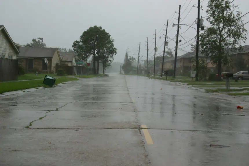
While some minimal development is still possible over the next 12 to 24 hours, the system is expected to reach the Louisiana coast later today. Given its current state, forecasters say it’s increasingly unlikely that it will reach tropical depression status before making landfall.
Still, the weather threat is far from over. Whether or not Invest 93L earns the name Dexter, heavy rainfall and localized flash flooding remain the primary concerns across the north-central Gulf Coast—including parts of Louisiana, Mississippi, and Alabama—through Friday.
Rain, not wind, is the bigger threat
Forecasters emphasize that even without a formal storm classification, this system is capable of producing dangerous rain totals, particularly in low-lying or flood-prone areas. Temperatures across the Gulf states are currently hovering around 86°F (30°C), with high humidity amplifying the tropical feel.
AccuWeather’s lead hurricane expert, Alex DaSilva, told Newsweek, “We’re closely watching this tropical rainstorm as it approaches Louisiana. Right now, the storm’s center appears to be just southwest of Mobile, Alabama, but it’s still disorganized. There’s a small window for it to strengthen slightly before landfall, but that window is closing fast.”
In a statement issued earlier this week, DaSilva warned that flooding could become a major issue through the weekend as the system tracks inland: “You don’t need a named storm to see real impacts. This is still a serious flooding risk.”
A messy system with little structure
Meteorologist Dylan Federico, writing on X Wednesday, offered a blunt take on the system’s status: “Invest #93L looks like a plate of scrambled eggs this morning on satellite. I thought it had a shot at becoming a depression yesterday, but it’s a mess. A long way to go before it’s named #Dexter.”
Despite its messy appearance, NHC forecasters will continue to monitor Invest 93L closely. As of now, they’re maintaining a 30 percent chance of cyclone formation within both the next 48 hours and the next seven days.
Three storms already named this season
The 2025 Atlantic hurricane season has already seen three named storms: Andrea, Barry, and Chantal. Chantal made headlines earlier this month for bringing widespread flooding to North Carolina. The Atlantic season officially runs from June 1 through November 30, while the Eastern Pacific season began May 15 and ends on the same date.
As always, the forecast remains subject to change, and meteorologists across the Gulf Coast are keeping a close eye on every update.


