

Millions across the United States are still battling the relentless summer heat, and now eyes are turning toward fall 2025. According to the latest long-range outlook from The Old Farmer’s Almanac, warmer-than-average conditions are expected to dominate this year’s autumn, particularly across much of the Western and Southern United States. The publication, which has been forecasting the weather since 1792, released its fall projections on July 11, 2025, and is warning that fans and air conditioners might be needed longer than usual.
The Old Farmer’s Almanac blends solar cycles, meteorology, and climatology to develop its seasonal forecasts. For this fall, it predicts above-normal temperatures across a large portion of the country — especially in the Atlantic Corridor, Florida, Southeast, Deep South, Heartland, Texas-Oklahoma, High Plains, Intermountain West, Pacific Northwest, Pacific Southwest, and even Alaska. The traditional pumpkin patch experience may feel more like a late-summer scorcher than a crisp autumn outing.
In addition to the heat, much of the U.S. is expected to experience below-average precipitation, stretching from California across to Florida and all the way up through Maine. However, regions such as the High Plains and Pacific Northwest could defy this trend with slightly wetter conditions.
Not all parts of the country will feel the same effects. A different pattern is taking shape in the Northeast, Appalachians, Ohio Valley, Upper Midwest, and Lower Great Lakes. According to Fox News, citing the same Almanac data, these regions will likely see cooler and drier weather, perfect for those hoping to enjoy a vibrant and early leaf-peeping season.
In New England, average temperatures are projected to settle around 59°F (15°C) in September and drop to 46°F (8°C) by October. In the Appalachian Mountains, the same months may see respective averages of 65°F (18°C) and 53°F (12°C).
The Southeast and Florida are forecasted to stay hot and dry, with September temperatures hovering between 78°F and 82°F (26°C–28°C) — higher than seasonal norms. Meanwhile, the Pacific Northwest is predicted to be warmer overall, but October may bring some increased rainfall.
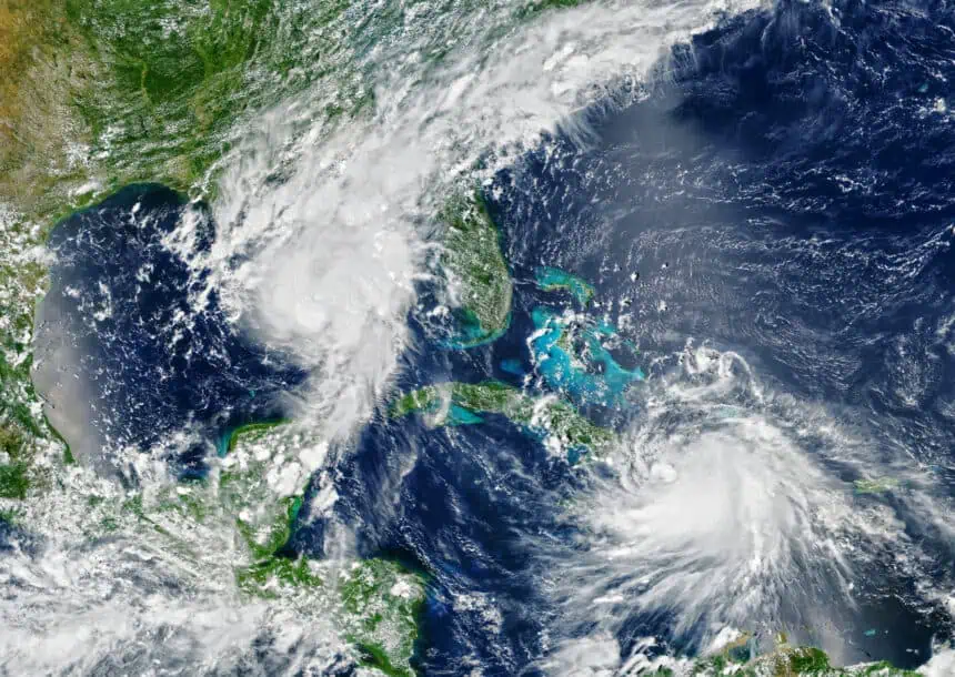
Although fall is on the horizon, the Atlantic hurricane season remains in full swing. The Old Farmer’s Almanac has flagged the possibility of above-normal tropical activity continuing through November, with a high number of named storms still expected to develop.
However, not all meteorologists agree with the Almanac. The National Oceanic and Atmospheric Administration (NOAA) is forecasting a warmer-than-average fall in the Northeast, diverging from the Almanac’s projection of cooler conditions. This difference is attributed in part to elevated Atlantic Ocean temperatures, which can influence regional warmth well into autumn.
On the rainfall front, both NOAA and the Almanac agree that the Southern Plains and Rockies will remain drier than usual, but they split on predictions for the Northern Plains. NOAA anticipates normal to below-normal precipitation, whereas the Almanac suggests above-average rainfall for that region.
As of today, Saturday, July 26, 2025, much of New York State continues to feel the lingering heat of summer, but with fall just weeks away, the next seasonal shift is shaping up to be anything but typical.


