

Sudden change after May heatwave
After several days of record-breaking heat across Spain, a major weather shift is expected starting Sunday, as the polar jet stream begins to dip southward. This undulation will form a trough, or vaguada, which is forecast to intensify thunderstorms, particularly across northern parts of the Iberian Peninsula early next week.
Over the past few days, unseasonably high temperatures have dominated the weather narrative. In Andalusia’s Guadalquivir Valley and the southern part of Extremadura, the mercury could climb to 104 °F (40 °C) —an exceptional value for late May.
Polar trough to sweep the peninsula
While heat remains dominant, several atmospheric waves will ripple across the country starting Saturday, culminating in the arrival of a more pronounced trough on Sunday. This cold air aloft, driven by a deep depression near the British Isles, will interact with the warm, unstable surface air, setting the stage for strong convection and intense thunderstorms.
The current high-pressure ridge over southwestern Europe is allowing calm, sunny conditions and record temperatures not just in Spain, but also in Portugal and parts of France. This ridge will break down as the trough pushes east, replacing stability with widespread instability, particularly in northern Spain.
Where and when storms are likely
As of today, exact locations of the strongest storms remain uncertain, but forecast models highlight the northern third of Spain as the most likely area to be affected. Regions such as Galicia, Asturias, Cantabria, La Rioja, the Basque Country, and the northern areas of Aragón and Catalonia are expected to experience significant rainfall and frequent thunderstorms, especially in mountain ranges.
Some isolated development could occur over Sierra Nevada, the Central System, and the Iberian Range, though storms in these areas should be weaker and more scattered.
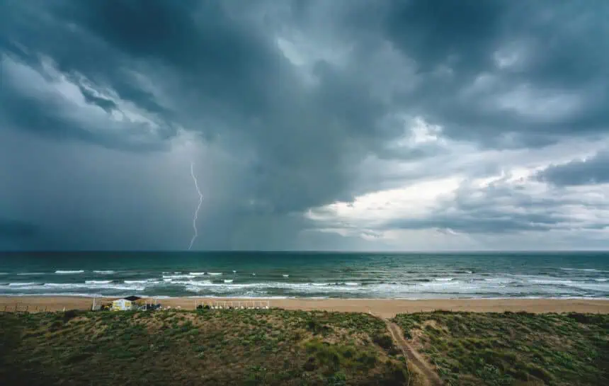
Severe weather threats: hail, wind gusts, and lightning
By Sunday afternoon, the unstable atmospheric setup may result in severe convective storms. These may bring hail, damaging wind gusts, and frequent lightning. Electric storm activity could be particularly intense in northern regions as the polar trough peaks in influence.
Forecast updates will refine the storm track and intensity, but residents in affected areas should be aware of the potential for rapidly developing adverse weather beginning late Sunday and continuing into early next week.


