

Severe weather threat returns across North Georgia and metro Atlanta
The Atlanta metropolitan area and much of North Georgia are bracing for another round of severe weather today, with the threat of damaging winds, large hail, and isolated tornadoes looming once again. Although the showers from Thursday have cleared, a cold front pushing in from the northwest is expected to create a much more volatile storm setup, prompting meteorologists to urge residents to remain weather-aware throughout the day.
What’s driving today’s storm system
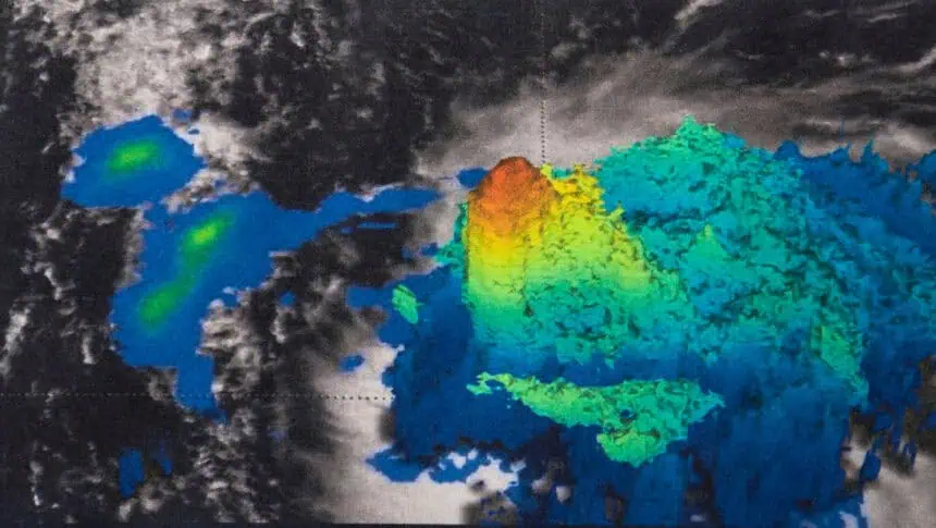
Unlike the moisture-fed showers that moved in from the Gulf of Mexico earlier this week, today’s weather pattern is driven by a strong frontal boundary. This cold front is forecast to ignite a line of thunderstorms, with instability and wind shear combining to support storm rotation and the chance for isolated spin-up tornadoes. Meteorologists say these could occur along the leading edge of the storm line as it sweeps through the region.
Timing the storm’s path: When and where it hits
The first storms are expected to develop around 9:00 to 10:00 a.m. over Northwest Georgia, impacting communities like Rome, Ellijay, and Blairsville. As the front advances southeast, metro Atlanta will likely see intense downpours and strong winds beginning around noon. This fast-moving system could bring brief but powerful bursts of severe weather, with the greatest tornado threat focused on areas marked as Level 2 (out of 5) in the Storm Severity Scale.
By early to mid-afternoon, around 2:00 to 3:00 p.m., the line of storms should move through central Georgia, including Eatonton and Thomaston, before tapering off. Rainfall totals could range from 0.5 to 1 inch (12 to 25 mm), potentially exacerbating flooding concerns in already saturated zones.
What to expect after the front moves through
Following today’s active weather, conditions are expected to improve dramatically. The weekend forecast looks much calmer, with sunshine dominating and temperatures rising to the mid-80s Fahrenheit (around 29 °C). By the middle of next week, highs may approach 90 °F (32 °C) across parts of Georgia.
Safety remains critical as storms strike
Residents should be prepared for rapidly changing conditions and review tornado safety plans. It’s essential to have multiple alert sources, including smartphone apps, NOAA weather radios, and local news outlets. If a Tornado Warning is issued, take shelter immediately in a basement or interior room, and avoid mobile homes or vehicles, which are highly vulnerable.
As severe weather continues to impact North Georgia, staying informed and prepared is the best way to navigate today’s turbulent forecast.


