

A record-breaking storm season across the Lone Star State
Texas has just experienced one of its most active severe weather seasons in recent memory. Since March 1, when meteorological spring began, the National Weather Service (NWS) has tallied 1,194 severe hail reports across the state — a figure that is nearly 40% above average. To put this into perspective, Oklahoma, the second-highest reporting state, has recorded only 483 hail events.
Meanwhile, 112 tornadoes have been confirmed statewide over the same period — a number just slightly above seasonal norms, but still a clear reminder of how volatile this spring has been.
Why this season was so intense
The intensity of this season’s weather was fueled by the interaction of upper-level low pressure systems with moisture-laden air masses traveling northward from the Gulf of Mexico. These systems have consistently generated favorable conditions for thunderstorm development, with frequent episodes of large hail, tornadoes, and heavy rainfall, particularly across Central Texas.
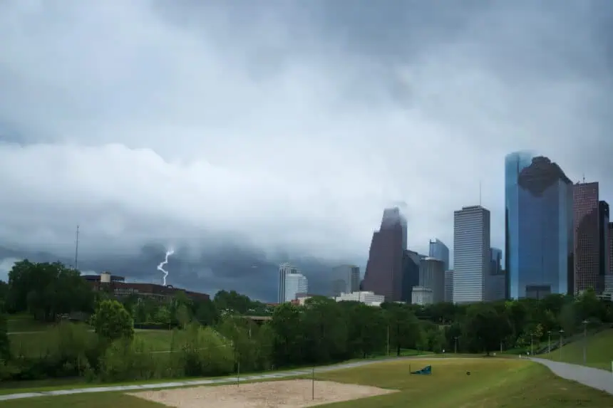
An example of this was seen on May 28 in Austin, where Camp Mabry recorded more than one inch of rainfall under the advance of dramatic storm clouds.
When does severe weather season typically end in Texas?
While May is historically the peak for severe weather in Texas — averaging 372 hail reports and 43 tornadoes — conditions begin to shift by June. Both hail and tornado reports drop sharply: hail by 59% and tornadoes by 74% compared to May’s numbers.
That said, June still ranks as the third-most active month for severe storms in the state, with most activity concentrated in the first two weeks. By late June, a seasonal high-pressure system usually sets up across the region. This system promotes sinking air, which in turn inhibits thunderstorm development and prevents cold fronts from advancing into Texas.
Because of this transition, severe hail reports plunge by 89% from June to July, and tornadoes become rare, with just four on average for the entire state in July.
What to expect in the coming days
Looking ahead to June 9–13, weather models suggest a renewed wave of atmospheric activity, particularly across South Texas, which is expected to receive above-normal rainfall according to the Climate Prediction Center.
While a widespread outbreak of severe storms is not forecast, the return of daily thunderstorm chances means isolated hail events — similar to what San Antonio experienced in late May — remain a possibility.
The atmospheric shift after the summer solstice
After the summer solstice on June 20, the atmospheric environment over Texas generally becomes less conducive to violent weather. As the subtropical high pressure system tightens its grip on the region, storm chances drop dramatically, especially for the kind of large hail and tornado-producing supercells that dominated the spring months.
Despite the expected decrease in severe weather, intense summer downpours are still possible. However, due to the high freezing level in the summer atmosphere, any hail that forms is unlikely to reach the ground before melting.
As of today, June 5, Texans are entering what is likely the final stretch of this year’s severe weather season. A few more stormy days may be ahead — especially across the southern half of the state — but the most dangerous period is now largely behind us.


