

Severe thunderstorms threaten northern Illinois Tuesday evening
Northern Illinois, particularly areas west of the Chicago metro, is under a “marginal” Level 1 of 5 risk for severe thunderstorms today, Tuesday, June 17, according to the National Weather Service. The risk zone includes Rockford, Dixon, and Ottawa.
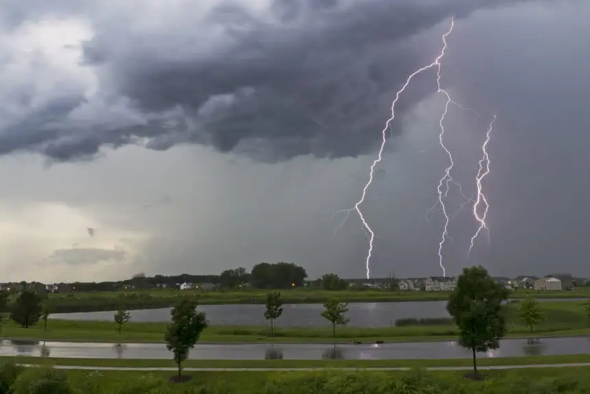
Scattered storms are expected to develop between 4 p.m. and 10 p.m., with cells moving east at 20 to 30 mph. The strongest storms could bring damaging wind gusts, which may down tree limbs, along with small hail. All storms today carry the threat of cloud-to-ground lightning and localized downpours, which could impact visibility and driving conditions.
Wednesday’s storms: Increased severity, wider area of impact
The situation intensifies Wednesday, with most of northern Illinois under a Level 2 “slight” risk, and an enhanced Level 3 risk approaching from the southeast. These storms are forecast to arrive Wednesday afternoon and evening, and may produce damaging straight-line winds, large hail, and even isolated tornadoes.
Compounding the severe weather threat, the risk for flash flooding increases, with a Level 1 of 4 flood threat issued. Forecast models indicate heavy, torrential rainfall, capable of overwhelming drainage systems and causing urban flooding, particularly in low-lying areas.
What residents in northern Illinois should know
Authorities urge residents to monitor weather alerts closely. The National Weather Service recommends maintaining multiple methods of receiving warnings, such as weather radios, mobile alerts, and local media updates. If thunder is heard, individuals are strongly encouraged to seek immediate shelter indoors.
Expect unstable and potentially dangerous weather patterns to persist through Wednesday night, particularly across rural and suburban areas west and northwest of Chicago.


