
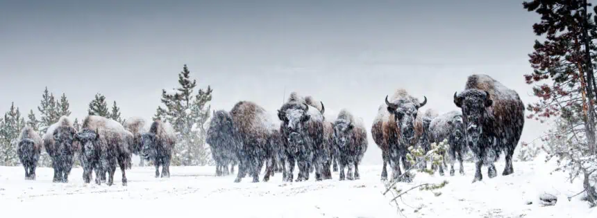

A rare and intense winter storm is set to sweep across northern Montana this weekend, delivering up to 12 inches (30 cm) of heavy, wet snow across the higher elevations of Glacier National Park.
According to the National Weather Service, snowfall is expected to begin by Saturday afternoon, peaking overnight and tapering off by Sunday morning. Logan Pass, Marias Pass, and the remote regions of the Flathead National Forest are all forecast to be impacted, with snow levels dipping as low as 4,000 feet, bringing up to 4 inches (10 cm) of accumulation even in some valley areas.
Why this June storm is highly unusual
Snow in June is not unheard of in the highest parts of the Rockies, especially within Glacier National Park, where elevations above 6,000 feet often remain snow-covered well into early summer. However, the intensity of this weekend’s system—with gusts reaching 40 mph, slushy roadways, and hazardous hiking trails—is extremely rare for this time of year.
The contrast is particularly stark when much of the continental U.S. is facing heatwaves, making the return of winter conditions in Montana a striking example of the nation’s increasingly unpredictable seasonal patterns.
Widespread hazards and potential impacts
The weather alert, issued Wednesday by NWS offices in Great Falls and Missoula, highlights hazardous driving conditions, especially on key routes such as Going-to-the-Sun Road, Looking Glass Road, and US Highway 89 over the Hudson Bay Divide.
The combination of wet snow and strong winds increases the risk of falling trees and power outages, particularly in forested high-elevation zones. Trail conditions will also deteriorate rapidly, posing serious risks to hikers and campers in the backcountry.
“Those looking to recreate in the backcountry of Glacier National Park should be prepared for adverse trail conditions and consider altering their plans,” the National Weather Service warned.
Backcountry conditions expected to worsen
Forecasters emphasize that hikers and outdoor enthusiasts in Glacier National Park will encounter treacherous trail conditions, with snow-loading on tree limbs raising the likelihood of fall hazards. The Missoula NWS office posted Thursday on X (formerly Twitter):
“High elevation snow is anticipated in @GlacierNPS Saturday evening into Sunday above 4000 feet. If you plan to recreate, be prepared for difficult conditions in the backcountry.”
What to expect next
The storm’s most intense period is expected overnight Saturday into early Sunday, though snow may begin falling by Saturday afternoon.
Park officials may close roads or trails as needed, depending on snowfall rates and tree damage. Travelers with plans to visit Glacier National Park this weekend should be ready for rapidly changing conditions, with the potential for hypothermia risks, delays, or infrastructure disruptions if snow accumulates more rapidly than forecasted.
Stay tuned for updates from the National Weather Service and Glacier National Park authorities as the storm approaches.


