

California’s first significant summer heat wave is on the horizon, expected to arrive next week as a large ridge of high pressure builds across the Southwest. After a cooler-than-average June and a mild Fourth of July, forecast models are now signaling a shift to a classic mid-summer pattern: a sprawling dome of heat pushing temperatures to dangerous highs across much of the Western United States.
Peak heat expected between Tuesday and Friday
The most intense part of this heat wave is projected to occur between Tuesday, July 8, and Friday, July 11, as the upper-level high pressure system strengthens over New Mexico and Arizona, then gradually shifts toward Southern California. Clockwise circulation around the ridge will help maintain a southwest flow along the California coast, preserving the marine layer and keeping coastal temperatures relatively mild.
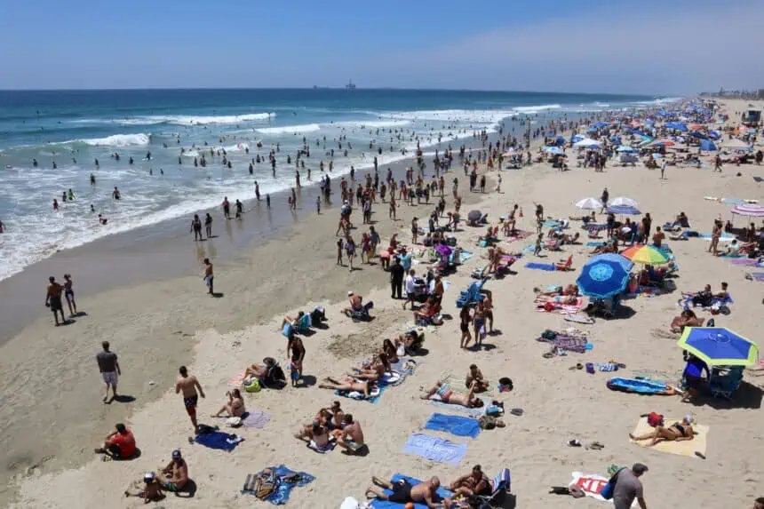
That said, inland areas will experience a very different story, with widespread 100s°F (38+°C) anticipated.
Southwest and interior West to feel initial blast
The heat wave begins in earnest Tuesday, impacting the Southwest and interior West first. Phoenix, Las Vegas, and Palm Springs will approach 110°F (43°C), while the heat spreads north through the Great Basin and into Oregon, Washington, and Idaho. Cities like Boise, Spokane, and Medford are forecast to run 10 to 15 degrees above normal, with highs reaching well into the 90s°F (32–37°C) and possibly higher.
Bay Area: mild coast, intense inland warmth
Along the Bay Area coast — including San Francisco, the Peninsula, South Bay, and the Santa Cruz Mountains — temperatures will remain more moderate. Highs will peak in the 80s to low 90s°F (27–33°C) on Wednesday and Thursday, the likely peak days statewide.
However, just a few miles inland, the intensity will escalate sharply. Parts of the East Bay and North Bay interior could see widespread 90s°F (32–37°C), with several locations likely crossing the 100°F (38°C) threshold by midweek.
Central Valley and Southern California to face extreme heat
The Central Valley and inland Southern California will bear the brunt of this heat wave starting Wednesday. Cities from Redding to Fresno, Bakersfield to Riverside, are expected to experience multiple consecutive days of triple-digit heat, with highs ranging from 100°F to 110°F (38–43°C).
The Mojave Desert and high desert regions could get even hotter, particularly on Thursday and Friday, when the ridge’s influence will be strongest over Southern California.
Heat wave to ease by the weekend, but fire risk climbs
The good news: most forecast models suggest this won’t be a prolonged event. The ridge is expected to weaken and shift eastward by the weekend, allowing temperatures to moderate somewhat along the coast and in Northern California.
Still, triple-digit heat may linger longer in the Central Valley and inland Southern California. And any stretch of hot, dry weather in July increases the threat of wildfire. Fine fuels in the foothills of the Central Valley and along the western slopes of the Sierra Nevada are already dry. While offshore winds aren’t expected with this event, extreme heat and low humidity could bring critical fire weather conditions to inland zones.
Thursday, July 10 outlook for key regions
San Francisco: Persistent marine layer clouds will keep most of the city cool, especially west of Twin Peaks, including the Sunset and Richmond districts, where highs will remain in the upper 50s°F (14–15°C). Downtown may touch the low 60s°F (16–17°C). Afternoon west winds will gust 20 to 30 mph, with clouds and breezy conditions returning overnight. Lows in the mid-50s°F (12–13°C).
North Bay: Morning cloud cover from the Marin Coast inland through the 101 corridor will clear by early afternoon. Novato, Napa, and San Rafael will reach the mid to upper 70s°F (24–26°C), with Santa Rosa and Vacaville climbing into the 80s°F (27–29°C). Southwest winds will gust between 20 and 25 mph, stronger in passes and elevated areas. Overnight skies will stay mostly clear inland, with low clouds returning near water.
East Bay: Morning fog and clouds along the bay will give way to sunshine inland. Highs in Richmond, Berkeley, and Oakland will reach the upper 60s to low 70s°F (20–22°C). The Tri-Valley area will see low 80s°F (27°C). Afternoon west winds will be strong, 20 to 30 mph, with gustier winds possible through interior passes. Overnight lows in the 50s°F (10–13°C).
Pacific Coast and Peninsula: A cool, cloudy, and breezy day along the Pacific Coast. Half Moon Bay and Pacifica will stay in the upper 50s°F (14–15°C). The Peninsula will see partial afternoon sun, with highs in South San Francisco and San Mateo in the mid to upper 60s°F (18–20°C). The San Bruno gap may see gusts up to 40 mph. Overnight, skies will stay mostly clear east of the ridge, with coastal clouds and lows in the 50s°F (10–13°C).
South Bay and Santa Cruz: Clouds will clear quickly through the Santa Clara Valley and Santa Cruz, allowing for a sunny afternoon. San Jose, Cupertino, and Milpitas will reach the mid to upper 70s°F (24–26°C), while coastal Santa Cruz will top out in the low 70s°F (21–22°C). West to northwest winds will be breezy at 10 to 20 mph, relaxing overnight. Lows will fall into the 50s°F (10–13°C).


