

FLORIDA – As of Thursday, July 4, the National Hurricane Center reports a 60% chance that a tropical or subtropical depression could develop off the Southeast coast, with particular focus on waters near Florida and extending toward Georgia and the Carolinas.
A broad area of low pressure is expected to take shape along a stalled front, which is already generating heavy rain and increased storm activity across Central and South Florida, from Orlando to Miami, including coastal zones like Daytona Beach and Tampa. These wet and stormy conditions are projected to continue through Friday and linger into the holiday weekend, with rainfall spreading northward along the Southeast coast.
Potential for tropical development near Florida
The development potential stems from a frontal boundary weakening over the western Atlantic, which could allow a low-pressure system to organize slowly over warm waters. While atmospheric conditions are currently only marginally favorable, there’s a moderate likelihood that this system could evolve into a tropical or subtropical depression late this weekend or early next week.
If a named storm does form, it would be called Chantal, the next name on the 2025 Atlantic hurricane list. However, forecasters do not expect any rapid or intense strengthening at this time. The system, if it develops, would likely remain poorly organized, with limited potential for intensification.
Storm impacts already underway in Florida
Regardless of tropical formation, this system is already having noticeable effects. Multiple rounds of thunderstorms are sweeping across Florida, with gusty winds, persistent downpours, and a risk of localized flash flooding, particularly in low-lying urban areas and places with poor drainage.
By Saturday and Sunday, the unsettled weather will expand across parts of southeast Georgia and the coastal Carolinas, potentially affecting cities like Savannah, Charleston, and Wilmington.
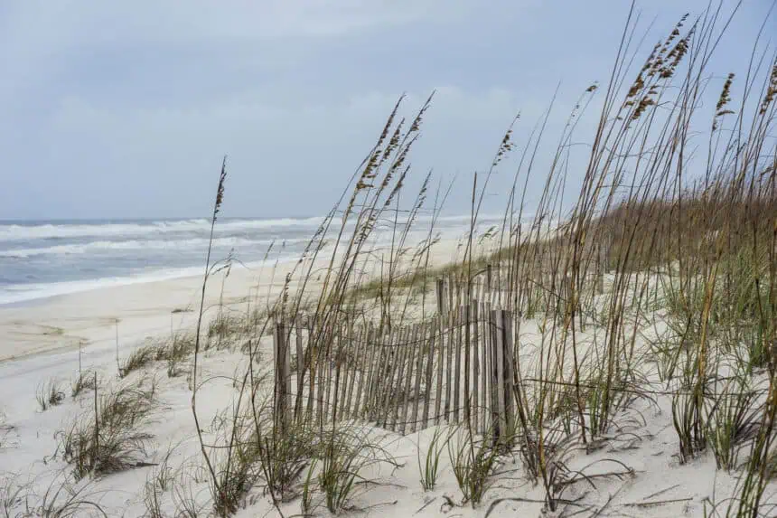
Beach and travel concerns for the Fourth of July weekend
Beach conditions across the Southeast coastline will be unreliable this weekend, as waves of heavy showers and occasional lightning disrupt typical afternoon sunshine. Rip currents may pose a serious risk along shores from Cape Canaveral to Myrtle Beach, particularly with the onshore flow tied to the developing low.
Vacationers and locals along the Atlantic coast should be aware of changing flags at lifeguard stations, which indicate ocean hazards like strong surf and dangerous currents.
Rainfall forecast through Monday
Projected rainfall totals show widespread 1 to 3 inches (25 to 75 mm) of precipitation across Central and South Florida, with isolated pockets exceeding 4 inches (100 mm), particularly where storms persist. Farther north, into Georgia and the Carolinas, lighter amounts are expected, but totals could increase if the low becomes more organized.
Stay tuned for updated forecasts as conditions evolve heading into the weekend.


