

DALLAS — A flash flood warning remains in effect for parts of northern Dallas County, including Farmers Branch, Carrollton, Addison, and portions of Plano, through midnight Saturday, as heavy rain continues to move through the Dallas-Fort Worth metroplex.
Early morning showers added to an already humid and unstable atmosphere, setting the stage for more rain and scattered storms later in the day. The National Weather Service has labeled the threat “considerable,” citing the potential for flooding in urban and low-lying areas.
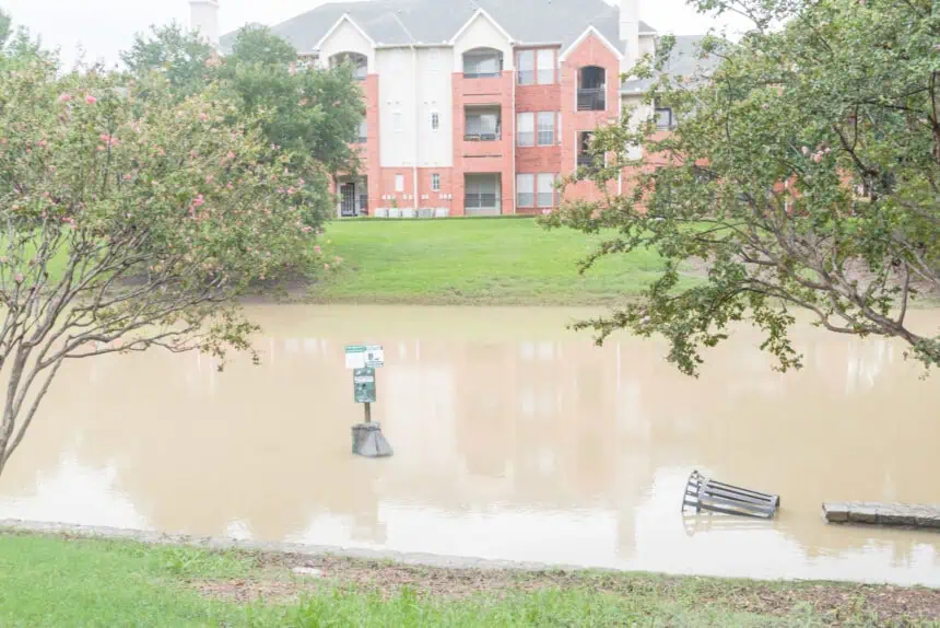
Localized flooding, emergency response in Carrollton
In Carrollton, city officials reported several weather-related incidents, including four water rescues, two house fires possibly sparked by lightning, and a train rerouted due to high water at a railroad crossing. While these events underscore the intensity of the conditions, there have been no confirmed injuries or major structural damage as of Saturday morning.
Saturday forecast: unsettled with storms likely
Rain is expected to taper off briefly through the late morning, but heavier showers and storms are likely to redevelop during the afternoon and evening, particularly across the northern and western edges of the metroplex. Conditions won’t be severe, but gusty winds and heavy rainfall could cause localized flooding, especially in flood-prone spots.
Temperatures will remain in the mid to upper 80s°F (around 31°C), with high humidity pushing the heat index into the low 90s°F (32–34°C).
Looking ahead: wet pattern into early next week
The weekend remains unsettled, with rain chances continuing through Sunday and into Monday. A flood watch remains active for parts of North and Central Texas through 7 p.m. Sunday, as forecasters keep an eye on additional rounds of slow-moving thunderstorms that could bring more downpours and flooding to the region.


