
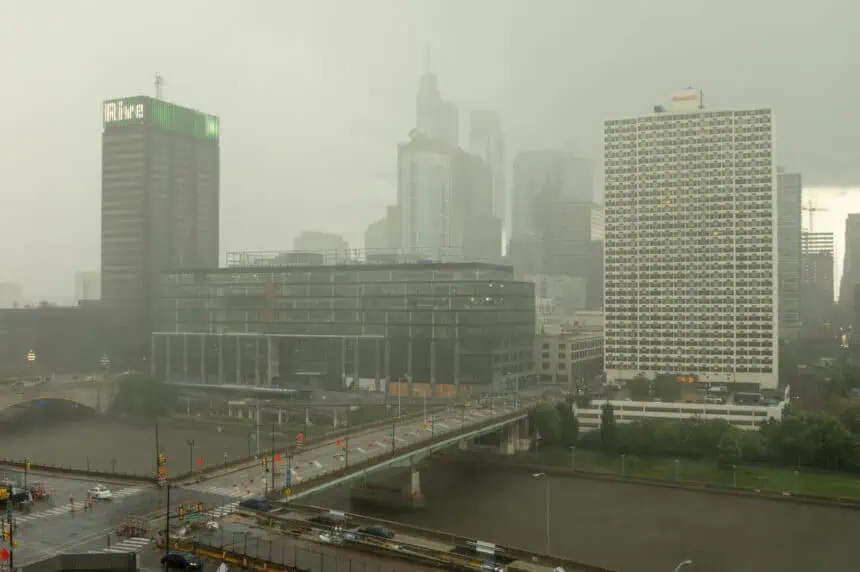
 Monday, July 14, is shaping up to be a NEXT Weather Alert day across the Philadelphia region, as the area braces for tropical downpours, localized flash flooding, and gusty winds. A cold front pushing in from the west is expected to trigger widespread showers and thunderstorms from the afternoon through the overnight hours. Some of these storms may stall over the same locations, producing heavy rainfall for extended periods.
Heavy rain and flash flood threat Monday into early Tuesday
Rainfall rates could climb to 1 to 2 inches per hour, with localized totals reaching 2 to 4 inches (51–102 mm) or more. This kind of tropical moisture—combined with already saturated ground conditions—sets the stage for urban and small stream flooding, especially in areas that see repeated rounds of storms.
The heaviest activity is expected to develop late Monday afternoon and continue into the evening and overnight. With rainfall potentially training over the same spots, the risk for flash flooding is notably higher.
Flash flood watch in effect for Philadelphia metro
A Flash Flood Watch is in effect from 2 p.m. to 11 p.m. Monday for much of the Philadelphia metro, stretching along the I-95 corridor and including portions of southeastern Pennsylvania, southern New Jersey, and Delaware. The Level 2 flood threat covers a densely populated swath of the region, raising concerns for the evening commute.
With the ground unable to absorb much more moisture, rapid runoff could flood roads, low-lying intersections, and creeks. Drivers are urged to avoid flooded roads and never attempt to drive through standing water.
Adding to the risks, weakened trees from previous rain events may topple, potentially leading to power outages or blocked roadways. While severe weather in terms of hail or tornadoes is unlikely, an isolated damaging wind gust cannot be ruled out.
Tuesday: stormy start, then gradual clearing
Tuesday morning could start off with lingering storms and spotty flooding, particularly in areas hit hardest Monday night. However, skies will gradually become partly sunny, and temperatures will rise to the upper 80s°F (around 31°C). Humidity levels will remain high, keeping conditions muggy and sticky throughout the day.
Typical summer pattern takes over midweek
From Wednesday through Friday, the region will shift into a more typical mid-July pattern, with partly sunny skies during the day and the daily risk of pop-up afternoon storms. Daytime highs will hover near the 90°F (32°C) mark, with overnight lows holding in the mid-70s°F (around 24°C).
Expect high humidity levels to push heat index values close to 100°F (38°C) during the peak of the afternoon. Forecasters are keeping a close eye on conditions, as heat alerts may become necessary by midweek.
7-day forecast for Philadelphia
Monday: NEXT Weather Alert – heavy rain and flash flooding. High 87°F (31°C), low 74°F (23°C).
Tuesday: Morning storms, then clearing. High 87°F (31°C), low 73°F (23°C).
Wednesday: Partly sunny, scattered storms. High 88°F (31°C), low 74°F (23°C).
Thursday: Hot and humid, storm chance late. High 92°F (33°C), low 75°F (24°C).
Friday: Mostly sunny with isolated storms. High 92°F (33°C), low 75°F (24°C).
Saturday: Mix of sun and clouds, stray storms. High 88°F (31°C), low 73°F (23°C).
Sunday: Warm, humid, scattered storms possible. High 91°F (33°C), low 75°F (24°C).


