

Tampa, Orlando and Daytona Beach are once again under serious flood threat as a tropical system begins to form over the Florida Peninsula, with potential development into a named storm as it moves toward the Gulf of Mexico. The National Hurricane Center gives it a medium chance of becoming a tropical depression by midweek—a pattern that could evolve rapidly as it reaches the warm Gulf waters, ideal for storm formation.
Right now, the system is an unorganized mass of showers and thunderstorms. However, once it enters the eastern Gulf, models suggest it could strengthen and potentially take the name Dexter, becoming the fourth named storm of the 2025 Atlantic hurricane season. This development would come earlier than average, as similar intensity typically isn’t seen until mid-August.
Warm ocean temperatures—well above seasonal averages—are adding fuel to this evolving system. Yet, strong upper-level winds may act as a brake, making intensification into a major storm less likely in the short term. Still, a few forecast models point toward a better-organized circulation by late week, with a possible tropical storm forming just off the Gulf Coast.
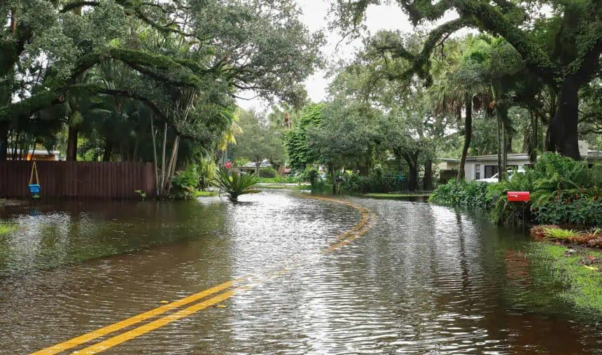
Even without reaching full tropical storm status, the system is expected to dump large amounts of tropical rainfall across much of Florida. On Tuesday, Daytona Beach recorded 2.25 inches (57 mm) of rain, breaking a daily rainfall record that had stood since July 15, 1935.
By Wednesday morning, a Level 2 out of 4 risk for flooding rainfall will affect parts of the Florida Peninsula, particularly around Tampa and Orlando, as the system draws in deep tropical moisture. The heaviest storms are likely in the afternoon and evening, with rainfall totals expected to reach 1 to 3 inches (25 to 76 mm) across central portions of the state.
The more dangerous phase of this storm system is expected later in the week as it tracks westward, bringing long-duration heavy rainfall to the north-central Gulf Coast, including southeastern Louisiana, Mississippi, and coastal Alabama. Starting as early as Wednesday night, the region could see persistent downpours, increasing the threat of flash flooding.
On Thursday, a Level 2 risk for flooding rain is forecast for New Orleans and surrounding areas of southeastern Louisiana and coastal Mississippi and Alabama. By Friday, the threat escalates to a Level 3 out of 4, especially around Baton Rouge, where several inches of rain may fall in localized areas. The most critical concern is that slow movement of the system could cause rain bands to stall, repeatedly soaking the same locations.
Though the path, strength, and speed of the system remain uncertain, what is increasingly clear is that widespread flooding is becoming likely for Florida and the Gulf Coast. The next 24 to 48 hours will be crucial to determine how this evolving system impacts the region.


