

Severe weather continues to loom over much of Minnesota and Wisconsin this Tuesday into Wednesday, with the potential for torrential rain, localized flash flooding, damaging winds, and large hail. The latest updates from meteorological centers paint a complex and evolving picture, especially for east-central Minnesota and northwest Wisconsin, where the risk for flash flooding is being closely monitored.
Heavy rainfall threat in Minnesota and Wisconsin from Tuesday to Wednesday
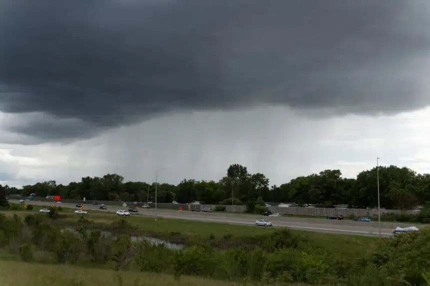
According to the National Weather Service in Duluth, storm systems could repeatedly pass over the same areas, a phenomenon known as storm training, which could result in localized flash flooding. Forecast models indicate the heaviest rain will likely fall Tuesday afternoon through Wednesday morning, primarily impacting east-central Minnesota and the northwest region of Wisconsin.
Forecasters in Duluth emphasized that “heavy rainfall rates and training storms repeating over and over again will lead to localized flash flooding,” suggesting an elevated threat level. Storm totals could reach or exceed 3 to 4 inches (76 to 102 mm) in certain areas, especially where multiple rounds of thunderstorms hit in succession.
Twin Cities forecasters signal lower flash flooding risk
In contrast, the National Weather Service in the Twin Cities acknowledges the possibility of heavy rainfall but notes a lower likelihood of widespread flash flooding. Their outlook highlights that the accumulated rainfall will likely occur over several separate storm waves, allowing intermittent drainage and reducing the chance of extreme runoff. Their models also point toward localized rainfall totals of 3–4 inches (76–102 mm), but without persistent storm training.
NOAA maintains slight risk for excessive rainfall
The Weather Prediction Center (WPC) from NOAA has placed a broad swath — stretching from Nebraska to the Arrowhead of Minnesota — under a slight risk for excessive rainfall. According to WPC analysts, “widespread convection with heavy rainfall rates of 1 to 2 inches per hour (25 to 50 mm/hr) is expected,” and storms could align from southwest to northeast, increasing the risk of repetitive downpours over the same region.
Severe thunderstorm risk: large hail and damaging winds
Beyond flooding concerns, severe storms are expected to erupt Tuesday afternoon, especially in central Minnesota, rapidly pushing eastward. The Storm Prediction Center (SPC) warns of “robust thunderstorms” capable of producing large hail and damaging straight-line winds. Initially, the cells may remain semi-discrete, favoring hail formation, but are forecast to transition into a linear complex, increasing the risk of broad wind damage.
However, the intensity of these storms is expected to decrease later in the evening as they move into areas with more stable atmospheric conditions, especially eastward across the Upper Great Lakes.
As always, residents in Minnesota and Wisconsin should stay alert to evolving weather developments and monitor official forecasts closely throughout the day and night.


