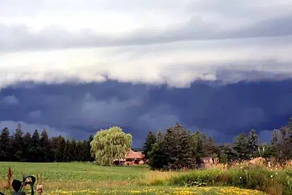



Severe thunderstorms sweep across northeastern British Columbia
On June 16, Environment Canada issued severe thunderstorm watch warnings for large parts of northeastern British Columbia, with particular attention to the south and north Peace River region.
Around 6:30 p.m. local time, meteorologists began tracking a strong thunderstorm system approximately 40 kilometres south of Fort St. John, moving northeastward at 30 km/h. This storm is capable of producing intense wind gusts, torrential rainfall, and hail as large as ping pong balls.
Widespread alert coverage across the region
In addition to the Peace River area, the weather alert covers a vast section stretching from the Alberta border, westward to Pink Mountain, and north beyond the Northwest Territories border. Another alert zone spans a triangular area from Dawson Creek and Chetwynd, along the Alberta boundary to a point near Prince George.
An additional severe thunderstorm watch was issued for the Fort Nelson region by Environment Canada, also on June 16.
Forecast outlook for today, Tuesday, June 17
According to Environment Canada’s forecasts, the threat of severe thunderstorms remains in place for Tuesday, June 17, across much of the northeastern region of the province.
The agency reminds residents: “When thunder roars, go indoors.” Although specific expiry times for the warnings have not been provided, the risk of strong thunderstorms persists throughout the day.
Particular vigilance is urged along major roadways and in vulnerable urban areas including Dawson Creek, Fort St. John, Chetwynd, and Fort Nelson.