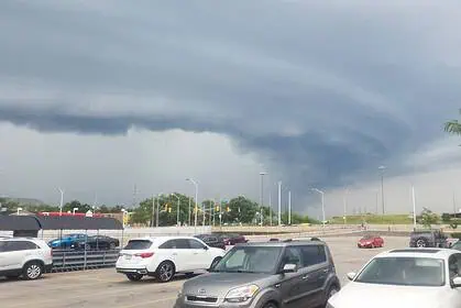



Southern Ontario is bracing for strong thunderstorms this Saturday, as an intense low-pressure system approaches from the United States, triggering volatile weather conditions across much of the province.
After two days of refreshingly dry air and sunny skies on Thursday and Friday, a noticeable shift is unfolding. A warm front tied to this system will drive temperatures up to 30°C (86°F) in parts of central and southern Ontario, fueling storm development throughout the day.
By the afternoon, thunderstorms will begin to form south of the border and sweep into Ontario, particularly targeting regions near Lake Huron and Georgian Bay. Communities from Muskoka to Sarnia should be especially alert by evening, as the potential for severe thunderstorms grows.
The most significant risks include damaging wind gusts and intense rainfall. Lightning will also be widespread. Though humidity levels won’t be as extreme as earlier in the month, rainfall amounts in active storm zones could still range from 10 to 30+ mm.
The Greater Toronto Area (GTA) can expect storm activity by late Saturday evening or into the overnight hours. While there’s some uncertainty about whether these cells will retain their strength, residents should still prepare for frequent lightning, brief but heavy downpours, and gusty winds.
On Sunday, the remnants of this storm system may linger, bringing isolated showers across parts of southern Ontario. However, an incoming high-pressure zone is forecast to push through, improving conditions and restoring seasonal temperatures, with a light touch of humidity persisting.
Stay alert for weather warnings and watch radar updates, especially if you’re in or near cottage country or along the Lake Ontario shoreline.