
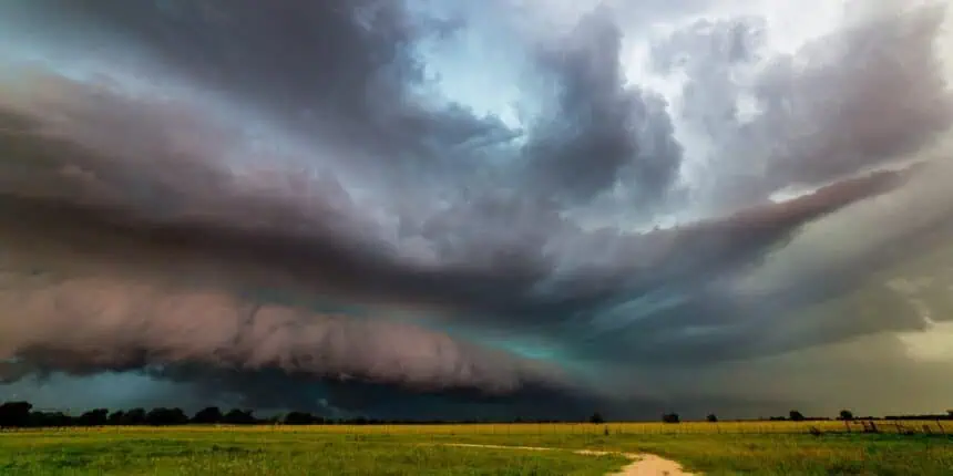

Stormy Friday morning in Harlingen, Texas
HARLINGEN, Texas — Friday began under threatening skies across deep South Texas, as isolated showers rapidly intensified into a powerful line of thunderstorms sweeping through Cameron County and surrounding areas. The early morning has been marked by loud thunderclaps, vivid lightning, torrential downpours, and several severe thunderstorm warnings.
The most intense impacts so far have included wind gusts reaching 70 mph (112 km/h) and hailstones the size of quarters — about 1 inch (2.5 cm) in diameter. These conditions have led to hazardous travel, and the line of storms continues to push southeastward through the morning hours.
Storm trajectory and afternoon threats
The primary line of storms is expected to clear out gradually by midday. However, residents shouldn’t become complacent. Even after the main system moves through, scattered showers and isolated thunderstorms will linger into the afternoon, particularly between late morning and 4 p.m..
Rain chances will remain elevated — between 30% and 40% — with additional rounds of storms possibly reaching severe limits. The atmosphere remains ripe for large hail — potentially up to golf ball-sized (1.75 inches or 4.4 cm) — and secondary wind gusts approaching 60 mph (97 km/h) in the strongest cells.
Stay aware throughout the day in South Texas, especially in areas stretching from Harlingen toward Brownsville and across the Lower Rio Grande Valley, as conditions remain volatile and potentially dangerous.


