
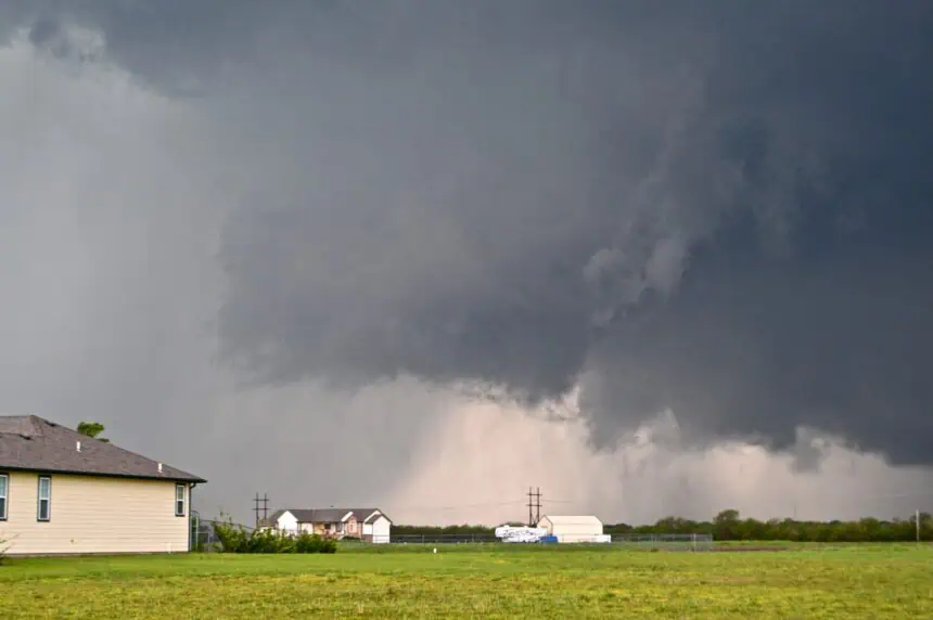

Strong thunderstorms sweeping across northern Missouri
Saturday afternoon, residents in the Kansas City region should stay alert as strong thunderstorms continue to track eastward through portions of northern Missouri. At 1:04 p.m., the National Weather Service issued a fresh alert covering several counties, including Clay, De Kalb, Daviess, Clinton, Caldwell, Ray, and Carroll.
The system is expected to produce wind gusts reaching up to 40 mph (64 km/h). These storms were observed on Doppler radar at 1:03 p.m., forming along a line from 7 miles south of Cameron to areas near Richmond, moving east at 15 mph (24 km/h).
Gusty winds may cause tree limbs to fall and can toss around unsecured outdoor items. The storm zone includes communities such as Lawson, Lathrop, Hamilton, Polo, Kidder, Rayville, and more. Interstate 35 in Missouri, from mile marker 37 to 53, is included in the affected corridor.
Localized flooding and rainfall risks
In addition to winds, torrential rain is being reported with these storms. This raises concerns about localized flooding, especially in low-lying areas and roadways with poor drainage.
The National Weather Service warns motorists: “Do not drive through flooded roadways.” Low visibility, potential hydroplaning, and flash flooding risks are especially high during such heavy downpours.
What to do during lightning threats
As summer storms become more frequent, so does lightning activity. The U.S. experiences around 25 million lightning strikes each year, with about 20 fatalities annually. Thunderstorms present the highest risk of lightning strikes when they are directly overhead.
Key reminders for storm safety:
If you’re outdoors, head to shelter immediately once thunder is audible or the sky darkens. Once indoors, avoid contact with electrical appliances, corded phones, plumbing, and windows. Wait at least 30 minutes after the last lightning strike or thunderclap before going back outside.
If you’re caught outside, stay away from open fields, hilltops, or tall isolated trees. Disperse if in a group. In campgrounds, choose valleys or low-lying areas, and remember: tents offer no protection from lightning. Avoid water, metal, and other conductors.
Safe driving in rain and stormy conditions
When driving in heavy rain, visibility and traction drop significantly. Turn on your headlights, even in daylight. Use center lanes to stay on higher ground, and avoid driving near road shoulders, where water tends to pool.
Stay clear of puddles and never drive through standing water. Larger vehicles like trucks can splash water that limits your vision, so keep your distance. If the roadway is flooded, turn around—never risk crossing it.
Understanding and reacting to hydroplaning
Hydroplaning occurs when a vehicle slides uncontrollably due to a thin layer of water separating the tires from the road surface. This is most likely when:
- Driving at high speeds
- Passing over deep or shallow water
- Using tires with worn-out treads
To recover from hydroplaning:
Ease off the accelerator, gently steer into the skid, and wait until your tires regain contact with the pavement. Brake gently, especially if your car has anti-lock brakes. With older brake systems, pump the brakes lightly instead.
Residents in the affected zones are advised to remain vigilant as the storm system continues to move through the region. Stay informed with weather updates throughout the day.


