
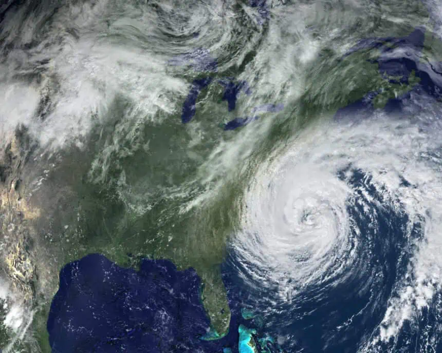

⛈️ New forecast raises alarm for the 2025 hurricane season
The 2025 Atlantic hurricane season, which officially started on June 1, is expected to be more intense than average, according to the updated forecast from Colorado State University (CSU). Meteorologists now warn that there’s a 51% chance that at least one major hurricane—Category 3 or higher—could strike the U.S. coastline this year.
This prediction reaffirms earlier projections from April, but recent ocean temperature readings and ENSO-neutral conditions in the tropical Pacific have solidified the forecast. As of today, Thursday, June 12, 2025, no named storms have formed yet in the Atlantic Basin, but the risk is building rapidly.
🌀 A closer look at the forecast zones
The CSU team has broken down the risk by region, giving coastal residents along the Eastern Seaboard and Gulf of Mexico a clearer view of what to expect:
- The Gulf Coast, including the Florida Panhandle, has a 33% chance of seeing a major hurricane make landfall.
- The East Coast, including the Florida Peninsula, faces a 26% chance.
- The Caribbean and the entire U.S. coastline are both projected to experience a season above the long-term average in terms of storm activity.
Even though the probabilities may not seem overwhelming, meteorologists strongly emphasize that “it only takes one hurricane” to severely impact an area. This is especially critical for urban centers, low-lying communities, and coastal infrastructure.
🌊 Why this season may turn volatile
Several key climate indicators are converging to suggest a highly active season in the Atlantic:
- Sea surface temperatures in the eastern and central tropical Atlantic are warmer than normal, creating more fuel for tropical systems.
- The El Niño-Southern Oscillation (ENSO) is currently in a neutral phase, which typically removes some of the atmospheric suppression that would otherwise inhibit storm formation.
The CSU report explains: “A warmer-than-normal Atlantic combined with ENSO-neutral conditions typically favors an active Atlantic hurricane season via dynamic and thermodynamic conditions conducive to developing hurricanes.”
These oceanic and atmospheric patterns, paired with the fact that last year’s season saw 18 named storms—11 hurricanes, and 5 major hurricanes—suggest that 2025 may follow a similar, if not more intense, path.
🗣️ Official warnings and key statements
The Colorado State University forecast underscores the importance of vigilance:
“Coastal residents are reminded that it only takes one hurricane making landfall to make it an active season for them. Thorough preparations should be made for every season, regardless of how much activity is predicted.”
Meanwhile, the National Hurricane Center (NHC) clarified in its most recent seven-day outlook that:
“Tropical cyclone formation is not expected in the Atlantic, Caribbean Sea or the Gulf of America during the next 7 days.”
Although no tropical systems are currently active, experts warn that the situation can escalate quickly—especially in late June through October, which are traditionally the most active months.
🌎 Eastern Pacific already active
While the Atlantic remains quiet for now, the Eastern Pacific hurricane season, which began on May 15, has already produced three named storms, including one hurricane. This contrast in activity between the two basins may shift as the summer heat continues to build, especially with July and August approaching.
Stay tuned for further updates as the season progresses, especially as tropical waves begin to emerge from the West African coast—a common breeding ground for major Atlantic hurricanes.


