
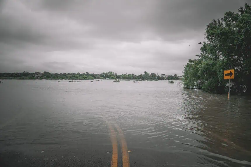

Flood watch in effect from Dallas to just north of Houston
A flood watch remains active through Thursday across several counties in Texas, stretching from the Dallas–Fort Worth Metroplex to regions just north of Houston, including Waco, Killeen, College Station, Centerville, and Brenham. The National Weather Service forecasts rainfall totals of up to 4 inches (102 mm) starting Wednesday afternoon, with localized areas potentially receiving up to 7 inches (178 mm).
This heavy rainfall is linked to a persistent upper-level low moving slowly across the state. Multiple rounds of showers and thunderstorms are anticipated through Wednesday night and Thursday, drifting east and northeast. Some of these storms could bring isolated damaging wind gusts and hail, but the primary hazard is flash flooding, especially south of Interstate 20.
North Texas temperatures and ongoing storm risk
In North Texas, high temperatures are expected to stay in the low 80s °F (27–28 °C) through Thursday, gradually warming to near 90 °F (32 °C) by the weekend. Despite the warmth, the severe weather threat is low overall, but not absent. Central Texas may experience more intense conditions, especially Wednesday afternoon.
Severe weather threat for Central Texas along I-10 corridor
Residents from San Antonio to areas east along Interstate 10 face a Level 2 of 5 risk for scattered severe thunderstorms on Wednesday. By Thursday, there is a greater chance of damaging winds, torrential rainfall, and large hail, especially along the eastern stretch of I-10. The NWS has warned of the potential for rapid intensification of storms during peak heating hours.
Daytime highs in Central Texas will likely climb to around 90 °F (32 °C), with temperatures trending back toward the triple digits by the weekend.
Houston and Southeast Texas monitor heavy urban rainfall
In Southeast Texas, including the Houston metro area, urban flash flooding is a growing concern. Bryan and College Station are already flagged for elevated flood risk, and Houston’s dense urban landscape makes it especially vulnerable to intense rainfall accumulation in short periods.
The NWS office in Southeast Texas noted Wednesday morning that rain performance will dictate updates to the watch status. A reconfiguration of the existing flood watch is possible depending on how precipitation evolves throughout the day and into Thursday.
As with the rest of the state, the storm threat in Southeast Texas includes damaging wind gusts and large hail. Daily shower and thunderstorm chances continue through Tuesday, with at least a 20 percent chance of storms each day.
Temperatures in Houston will hover in the lower 90s °F (32–34 °C), contributing to increased atmospheric instability and moisture retention, fueling further storm development.


