
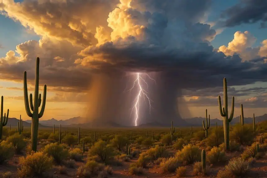
 TUCSON, Arizona — Monsoon moisture has officially made its seasonal debut across southeastern Arizona, and it’s already igniting the first isolated thunderstorms of the year. As of early Tuesday morning, June 24, 2025, atmospheric humidity continues to drift over the region, creating conditions favorable for spotty thunderstorm development.
Most of the thunderstorm activity is expected to remain southeast of Tucson, particularly over Cochise County, but a few cells may push westward, possibly reaching Tucson by Tuesday afternoon. These storms will be widely scattered, with some producing brief gusty winds and lightning.
Drier air is forecast to return by Wednesday, bringing temporary relief from the humidity, before another surge of monsoonal moisture rolls in by the end of the week. This renewed humid push is likely to trigger additional thunderstorm activity just in time for the weekend.
Temperatures will remain elevated, with daytime highs climbing into the low 100s Fahrenheit (around 38 °C) through midweek, and slightly warmer conditions expected by Friday and Saturday. The combination of heat and returning moisture will continue to build a classic summer setup across southern Arizona.
In Cochise County, residents can expect occasional clouds, with afternoon heating driving isolated thunderstorms, especially over higher elevations and along the southeastern slopes. Keep an eye on radar conditions, especially during the late afternoon to evening hours, when storm chances peak.
The monsoon season has officially begun, and with it comes the seasonal rhythm of sun, heat, and afternoon storms that define summer in the Southwest.


