

Florida residents and vacationers preparing for Independence Day festivities may want to keep a close eye on the sky. Meteorologists are tracking a potential tropical disturbance that could develop off the Southeast Atlantic coast or the Gulf of Mexico, bringing heavy rain and possible coastal impacts just as Fourth of July celebrations begin.
The National Hurricane Center (NHC) announced on Sunday, June 29, that it is monitoring a system with a 20% chance of development over the next seven days. Forecast models suggest that by late this week into the weekend, a low-pressure area may form from the remnants of a stalled front lingering near the Southeast coast or eastern Gulf.
Low-pressure system may develop off the Southeast coast
According to the NHC, gradual tropical or subtropical development could occur as the disturbance drifts slowly near the U.S. shoreline. This timing aligns uncomfortably with the July 4th holiday weekend, raising concerns about heavy rainfall, gusty winds, and beach disruptions.
Alex DaSilva, lead hurricane forecaster at AccuWeather, noted that both the Gulf of Mexico and the Atlantic waters just off the Southeast U.S. are common breeding grounds for tropical systems in early July. He explained that a cold front pushing into the region later this week could act as a catalyst for storm development, especially over the eastern Gulf or off the Florida Atlantic coast.
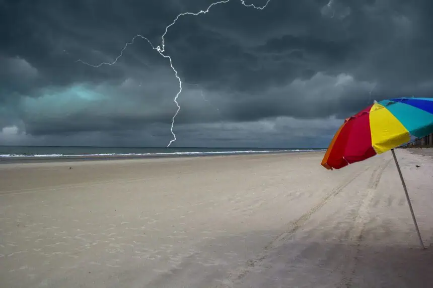
Rainy pattern may spoil Florida’s holiday weekend
Alex Sosnowski, a senior meteorologist at AccuWeather, added that after the peak heat in the Southeast, the weather pattern will likely shift to one favoring increased showers and thunderstorms leading into early July. He warned that this could disrupt beach outings, fireworks shows, and other Fourth of July activities across Florida.
Some areas of the Florida Peninsula may see much-needed rainfall in the coming days, but that’s bad news for beachgoers and tourists in the Sunshine State.
Barry becomes second named storm of Atlantic hurricane season
While the possible low-pressure system is still under development, another system in the Gulf of Mexico has already strengthened. The second tropical depression of the 2025 Atlantic hurricane season formed off the coast of eastern Mexico, bringing heavy rain and tropical-storm-force winds.
As of Sunday afternoon, the NHC confirmed that the system had been named Barry, marking the second named storm of the season. Maximum sustained winds reached 35 mph (55 km/h) with stronger gusts. A tropical storm warning was issued from Boca de Catan to Tecolutla as Barry was expected to make landfall in eastern Mexico later Sunday evening, dumping significant rain.
Warm waters, light wind shear could aid new system’s growth
Back near the U.S., forecaster DaSilva noted that wind shear — a key factor that often disrupts tropical formation — is expected to be low in the region. Meanwhile, ocean temperatures in the Gulf remain above average, further supporting potential tropical development.
If a new tropical storm does form near the Southeast coast early next month, it would be given the name Barry, unless the current storm retains it beyond its impact on Mexico.
The primary concern for Florida and surrounding coastal states heading into the holiday weekend remains torrential rainfall, which could result in localized flooding, especially in areas with poor drainage. Despite the sandy soil typical of Florida’s coastline, heavy downpours can temporarily overwhelm stormwater systems, leading to ponding on roads and highways.
Waterspouts and beach hazards possible near the coast
AccuWeather meteorologists also warned of potential waterspouts forming nearshore, especially in combination with intense thunderstorms. These weather conditions pose a direct threat to boaters, swimmers, and anyone planning a day at the beach.
Any greater impacts, including stronger winds, coastal erosion, or tidal flooding, will depend on whether this developing system intensifies into a tropical storm during the Independence Day weekend.


