

Kansas City is under siege from life-threatening flash floods this Friday morning, as a massive 1,000-mile-long storm system unloads relentless rain across the central United States, especially over northeast Kansas and northwest Missouri. What began as relief from the intense heat wave has quickly turned into a dangerous and disruptive weather emergency.
The NOAA’s Weather Prediction Center has issued a Level 3 out of 4 risk for moderate flooding in parts of the region, with the Kansas City metro suffering historic rainfall that has already tied a 125-year-old record. On Thursday, Kansas City registered 2.35 inches (59.7 mm) of rain, and the skies are showing no signs of letting up.
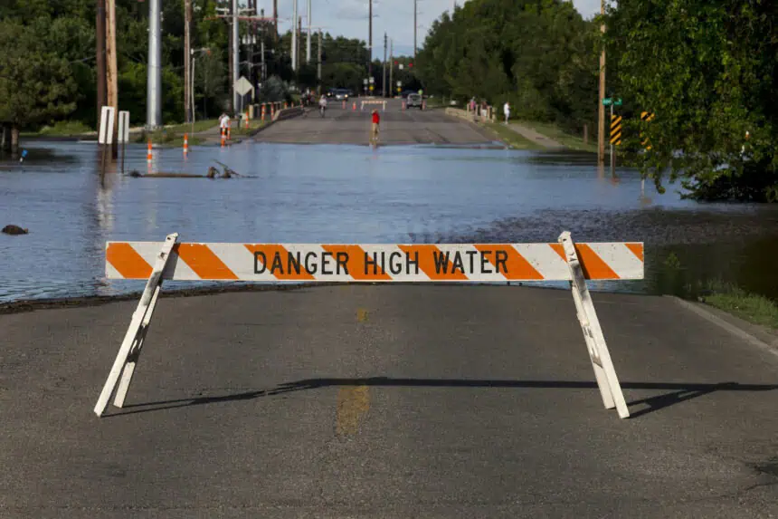
Flash Flood Warnings are active across large swaths of Kansas and Missouri, with some extended until 10 a.m. local time. MoDOT officials have reported water over sections of Interstate 70, triggering major traffic issues. Additional road closures include MO-78 east of I-435 in Jackson County, now completely blocked by floodwaters.
The FOX Forecast Center warns that this is far from over. Heavy storms will continue throughout Friday, with strong winds and a nonstop deluge falling over areas that are already saturated. Interstate 49 is also being heavily impacted, and local officials have strongly advised against non-essential travel before sunrise, labeling it a “no travel zone.”
Meteorologists at the National Weather Service in Kansas City are forecasting isolated totals between 9 and 12 inches (22.8 to 30.4 cm) in the hardest-hit areas, while many neighborhoods have already seen 3 to 4 inches (7.6 to 10.2 cm) dumped in less than 24 hours. Rainfall rates in the most intense storms may exceed 2 inches per hour (50.8 mm/h), particularly north of the I-70 corridor.
Flood Watches remain active across counties in Kansas, Nebraska, and Missouri, as a slow-moving frontal boundary continues to drive this multi-day weather threat into early Saturday. According to FOX Weather’s Stephen Morgan, the Pleasant Hill NWS office had already predicted a major flood event earlier this week.
Authorities are on high alert. Just days ago, a 62-year-old man was killed after being swept away near a flooded creek in Overland Park, southwest of Kansas City. The National Weather Service continues to stress that 6 inches (15.2 cm) of moving water can knock over an adult, and just 12 inches (30.4 cm) is enough to carry away most vehicles.
While the current outbreak is not expected to reach severe weather criteria, a few stronger thunderstorm cells may produce damaging wind gusts or prompt brief Tornado Warnings, especially around the Topeka region. Rainfall totals there over the past two weeks are between 300% and 600% above average, putting the area at extremely high risk for sudden flooding.
By the weekend, a shift in the pattern will bring a ridge of high pressure into the region. This will likely suppress rain chances, but also drive temperatures back up—with highs near 100°F (37.8°C) expected to return and persist well into next week.


