
 Unrelenting heat engulfs Northern California
A significant early-season heat wave is surging across California, bringing widespread triple-digit temperatures to the Central Valley and interior Northern California. Starting Thursday, temperatures soared 10 to 15 degrees above normal, particularly north of Interstate 80. Cities like Redding, Red Bluff, and Chico climbed into the upper 90s°F (around 37°C), while Sacramento and Stockton hit the low to mid-90s°F (33–35°C). In the Sierra foothills, places such as Grass Valley and Paradise reached the upper 80s°F (around 31°C).
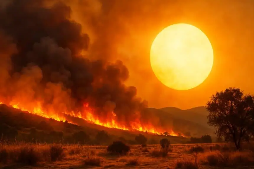
Friday marks the peak, with Redding and Red Bluff pushing 107°F (42°C), while Sacramento, Yuba City, and Oroville hover around 105°F (40°C). Even foothill towns will sweat under mid-90s°F (35°C) heat. Overnight lows near 70°F (21°C) may offer little relief, increasing health risks. Humidity will plunge into the teens, and breezy afternoon winds will spike fire danger.
By Saturday, a slight weakening in high pressure may lower temps just a bit—by about 5 degrees—but Redding and Red Bluff could still reach 105°F, while Sacramento and Modesto stay above 100°F. Fire weather conditions will remain dangerously elevated due to low humidity and increasing winds.
Sunday’s Pacific trough will finally bring cooler air, dropping highs into the low 90s°F (33°C) for Redding, upper 80s°F (31°C) for Sacramento, and mid-80s°F (29°C) in the foothills, as onshore flow strengthens and humidity slightly increases.
Bay Area’s inland neighborhoods sizzle under heat advisory
High pressure continues to heat up the Bay Area, especially inland. Thursday saw upper 80s to low 90s°F (31–33°C) in cities like Santa Rosa, Livermore, and San Jose, while coastal areas stayed cooler in the 60s and 70s°F (16–24°C).
Friday, the peak heat day, brings a heat advisory from 11 a.m. to 8 p.m. for interior North Bay, East Bay, South Bay, and the Santa Cruz Mountains. Expect temperatures 15–20 degrees above average: Santa Rosa, Livermore, and Walnut Creek may touch 100°F (38°C), while San Jose, Fremont, and Redwood City will reach the low 90s°F (33°C). Even San Francisco could hit the upper 70s°F (25°C), with Pacifica and Half Moon Bay warming to the low 70s°F (21–22°C).
Saturday’s modest cooldown brings mid- to upper 90s°F (35–36°C) to Livermore, Antioch, and Santa Rosa, while San Francisco eases into the low 70s°F (21°C) and coastal areas settle in the mid-60s°F (18°C). Fire weather risk remains, particularly in grasslands and foothills, due to low humidity and dry fuels.
Sunday’s shift will be more noticeable, especially inland. Cities like San Jose, Walnut Creek, and Concord will cool to the mid-80s°F (29°C), while Novato and Napa drop into the upper 70s°F (25°C). San Francisco will fall back to the upper 60s°F (20°C), and marine air will push farther inland, bringing improved overnight recovery.
Central California braces for the worst on Saturday
In the San Joaquin Valley, Thursday’s temps hovered in the low 90s°F (33°C), but the real heat arrived Friday, with a heat advisory from 11 a.m. Friday through 7 a.m. Sunday. Cities like Fresno, Visalia, Hanford, and Bakersfield will roast between 100 and 105°F (38–41°C). The Sierra foothills and even Yosemite Valley will approach 100°F (38°C). Kern County deserts will be bone-dry, with humidity dropping below 10%, exacerbating fire concerns.
Saturday will be the hottest day, as Bakersfield could exceed 106°F (41°C). The Mojave Desert and northern Kern County will hover around 105°F (40°C). The Sierra foothills, between 2,000 and 4,000 feet, will reach the upper 90s°F (36°C), while higher elevations remain in the 80s°F (27°C). Winds through the I-5 corridor and foothills will raise critical fire weather alerts.
Sunday won’t bring much relief. While most of the San Joaquin Valley drops to 95–100°F (35–38°C), Bakersfield may still cling to the century mark. Foothills and the mid-elevation Sierra will ease into the 70s and 80s°F (21–27°C), but new threats loom. Tropical Storm Alvin is pushing mid-level moisture into Southern California, increasing the risk of isolated thunderstorms across the southern Sierra and desert slopes—a volatile setup for wildfire ignition.
Dry air will linger across Northern California, but thunderstorm activity could complicate fire containment efforts as the weekend ends.


