

⛈️ Severe weather setup through Thursday morning
A trough of low pressure is moving across Texas, interacting with a weak cold front and intensifying Gulf moisture. This atmospheric combination is setting the stage for widespread thunderstorms and potential flash flooding across Central and South Texas, especially around San Antonio, over the next 36 hours.
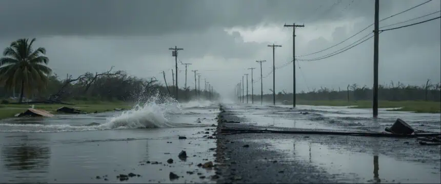
⚠️ Wednesday night into Thursday: San Antonio in spotlight
While a first cluster of thunderstorms passed through early Wednesday, dropping 0.4 to 0.8 inches of rain across Bexar County and nearly 2 inches across parts of the Hill Country from Kerrville to Fredericksburg, the most dangerous phase begins late tonight.
By 10 p.m. Wednesday, another strong line of storms is forecast to arrive. According to the Storm Prediction Center, San Antonio is under a Level 2 of 5 severe risk, with damaging winds, large hail, and localized flash flooding likely.
The core risk window is from 11 p.m. Wednesday through 7 a.m. Thursday. Radar projections suggest slow-moving cells, meaning flood-prone zones may see over 4 inches of rainfall. Those on the roads tonight into the early morning should expect dangerous travel conditions, with high water areas especially risky.
🌦️ Thursday: More rounds possible, uncertain rain totals
Storm activity may linger into Thursday, especially in the morning, followed by isolated storms into the afternoon. Rain chances are currently estimated between 50% and 60%, though not every area will receive new rainfall. However, saturated soils could exacerbate flooding, particularly in neighborhoods still recovering from earlier storms.
Temperatures on Thursday should reach the upper 80s to near 90°F (31 to 32°C), but elevated humidity will make it feel closer to 98°F (37°C). Morning lows will hover in the mid-70s°F (24°C), adding to the tropical feel.
📊 Forecast rainfall outlook through Friday
Forecast models remain highly variable, but the National Weather Service gives San Antonio a 32% chance of recording at least 3 inches (76 mm) of rain before the week ends. The most probable range is between 1 and 3 inches (25 to 76 mm), though areas farther north in the Hill Country may exceed these totals.
🌤️ Weekend: Reduced storm activity, warmer air returns
By the weekend, storm chances will taper to around 20%, with temperatures rebounding. By Saturday and Sunday, highs may reach mid-90s°F (35°C), signaling a return to typical early summer heat for South Texas.


