

AUSTIN (KXAN) – Central Texas is living through an extraordinary July, with the wettest start to the month ever recorded. Torrential and, at times, deadly downpours have dominated the first half of the month, turning what is usually one of the driest times of the year into a period of intense and prolonged rainfall.
A break from the typical summer weather
July in Central Texas is normally the second driest month of the year, with less than 2 inches of rain on average. The prevailing summer pattern tends to lock in hot, dry conditions, as high pressure systems settle over or just west of Texas, pushing down air that suppresses cloud and storm development.
But summer 2025 has flipped that script. After a scorching and dry June—ranked as the 15th hottest and 22nd driest on record, with only 0.85 inches (21.6 mm) of rainfall—July has taken a dramatically different turn.
How the pattern shifted in early July
In the final days of June and into early July, a significant atmospheric pattern shift occurred. High pressure over Texas slid westward over the Southwestern U.S., while a new high pressure zone formed far to the east. This opened a channel for tropical moisture, especially from the remnants of Tropical Storm Barry, which moved in around Independence Day and triggered a surge in rainfall.
With high pressure absent, air could rise more freely, setting up the ideal environment for rain-making systems to develop and linger over Central Texas. Storms lacked strong upper-level winds to steer them away quickly, allowing repeated and sometimes intense rain events to occur.
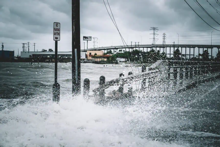
Historic rainfall totals in Austin
While the month isn’t over yet, Austin has already seen enough rainfall to place July 2025 among the wettest Julys ever recorded. Unfortunately, this excessive rainfall has brought dangerous flash flooding, especially across the Hill Country and northwestern parts of the Austin metro, with tragic consequences.
A return to dry weather soon
Current forecasts suggest that this two-week streak of nearly daily rain and thunderstorms is about to end. A strengthening high pressure system currently sitting to the east is expected to move westward, cutting off most chances for rain by this weekend. Only isolated sea breeze showers could sneak in along the Gulf Coast.
The Climate Prediction Center’s extended forecast shows a normal or drier-than-normal trend developing over much of the region for the second half of July.
Expect hotter days ahead
With the clouds and storms retreating, the temperature outlook is leaning toward a warmer-than-average finish to the month. For context, average highs in mid-to-late July range from the mid to upper 90s°F (35–37°C), so anything above that is notable.
What this means for the rest of summer
The recent rain is likely to change how the rest of the summer unfolds. Moist soil from these storms will slowly evaporate under the sun, raising humidity levels and creating muggier conditions. That extra moisture in the air will make nights warmer, but it may also keep daytime highs just below triple digits, something less likely during a dry, drought-driven summer.
Still, the increased humidity will make it feel hotter, potentially pushing heat index values well over 100°F (38°C) on sunny days.
The saturated ground will also temporarily reduce the wildfire risk, giving the region a brief reprieve from the high fire danger that typically escalates in late summer.


