

- Invest 93L weakens over Louisiana, but rain threat spreads
- Potential tornadoes and waterspouts near the Gulf Coast
- Florida impacts: Flooding risk in the Panhandle, high heat elsewhere
- Three tropical waves under surveillance
- Next name on 2025 hurricane list is Dexter
- What is an invest?
- Watch for additional updates and alerts
Invest 93L weakens over Louisiana, but rain threat spreads
Invest 93L, now classified as a tropical rainstorm by AccuWeather, is moving inland over southeastern Louisiana as of 2 p.m. Eastern Time on Thursday, July 17. The National Hurricane Center has lowered the chances of this system becoming a tropical depression, with just a 10% probability of development both in the next 48 hours and over the next week.
Although further intensification is unlikely, torrential rain remains a major concern. Widespread downpours are expected to impact much of the north-central Gulf Coast, particularly across southern Louisiana and southern Mississippi, through Friday.
The storm’s core remains disorganized, with shower and thunderstorm activity mainly displaced to its west and southwest. Despite its weakening, the system continues to deliver heavy rain bands, which could stall over the region due to light steering winds.
Localized rainfall totals of 8 to 12 inches are possible in parts of Louisiana, with isolated pockets potentially reaching an AccuWeather Local StormMax™ of 16 inches (40.6 cm). These conditions heighten the risk of flash flooding, especially in low-lying and poor-drainage areas.
Potential tornadoes and waterspouts near the Gulf Coast
AccuWeather warns that a few tornadoes or waterspouts may form along the central Gulf coast as the system pushes inland. Areas at greatest risk include southern Louisiana, the Mississippi Delta, and potentially parts of eastern Texas if the system continues drifting westward.
Forecast models show the rainstorm may either stall or gradually shift northwest, which could bring flooding rains toward eastern Texas, possibly approaching Houston, or move northward into the lower Mississippi Valley.
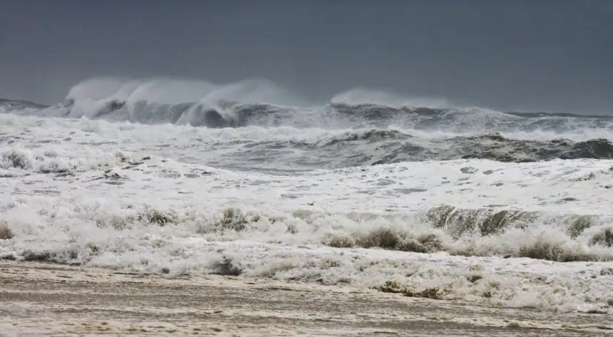
Florida impacts: Flooding risk in the Panhandle, high heat elsewhere
Florida is experiencing a mix of impacts from Invest 93L and broader tropical moisture. The Panhandle, particularly around Pensacola and Tallahassee, is seeing heavy rainfall, rip currents, and elevated surf conditions today, especially along Big Bend beaches.
Meanwhile, in North Florida, including Jacksonville, a warming trend is setting in, with inland highs nearing 100°F (38°C) into the weekend.
In Central and South Florida, areas from Daytona Beach to Stuart, and from West Palm Beach to Naples, can expect scattered to widespread storms, fueled by warm, humid air. The coastal stretch from Fort Myers to Sarasota is particularly vulnerable to flooding, especially during the afternoon and evening hours.
Three tropical waves under surveillance
Beyond Invest 93L, the National Hurricane Center is closely monitoring three tropical waves:
The first is in the far eastern Atlantic, near 27W, moving westward at speeds between 11 and 17 mph.
The second wave, located in the eastern Caribbean near 66W–67W, is traveling westward at 23 mph.
The third wave sits in the western Caribbean, around 79W–80W, also moving west at 23 mph.
There is also speculation of a new area of tropical development forming off the central U.S. coastline between July 22 and 25. This area could present another threat, potentially influencing Florida’s weather by late next week.
Next name on 2025 hurricane list is Dexter
As of mid-July, the 2025 Atlantic hurricane season has produced three named storms: Andrea, Barry, and Chantal. The next will be Dexter, with an average formation date of August 15. However, recent trends have shown earlier-than-usual development, as both Barry and Chantal formed ahead of historical averages.
An average hurricane season typically includes 14 named storms, 7 hurricanes, and 3 major hurricanes. The peak of the season still lies ahead, as most tropical activity typically occurs between August and October.
What is an invest?
The term “Invest” stands for “investigation”, used by the National Hurricane Center to designate a suspicious weather system under close observation. While not officially a tropical depression or storm, an invest allows meteorologists to run advanced forecasting models, monitor it more closely, and, when needed, send Hurricane Hunter aircraft for more precise data.
Current numbering runs from 90 to 99, followed by a letter — L for the Atlantic basin. Invest 93L is one of the systems now under that classification.
Watch for additional updates and alerts
The National Weather Service has issued various weather watches and warnings across Florida, especially for flash flooding and rip currents. For those in coastal areas of North Florida and the Panhandle, conditions could shift quickly with incoming rain bands and potential severe weather.
Real-time updates, including interactive storm maps and alerts by text, remain active as the situation evolves.


