
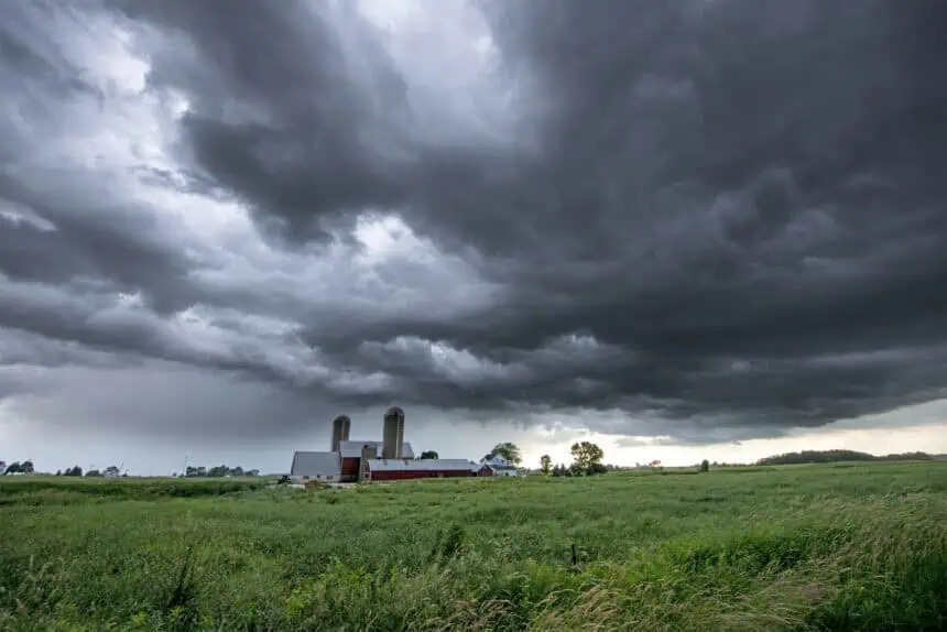

🌩️ Active start to the week in southern Wisconsin
A moist, unstable air mass lingers across southern Wisconsin this Monday, fueling scattered showers and isolated thunderstorms, primarily west of Madison. These disturbances are being driven by a shortwave trough combined with weak warm air advection—two ingredients that continue to stir up evening convection. While some showers may weaken tonight, clouds will persist across much of the region.
Overnight, another batch of light to moderate rainfall, with embedded thunderstorms, could redevelop after midnight and carry into early Monday morning, especially west of Madison. Afternoon skies may break at times, boosting inland temperatures into the mid-80s°F (29–30°C), while locations along Lake Michigan stay significantly cooler due to an onshore southeast breeze.
⛈️ Monday night into Tuesday: Storms gather strength
By late Monday night, models hint at a decaying mesoscale convective system (MCS) sweeping across northwestern Wisconsin. Although instability and shear remain modest, there’s still enough cold pool support to maintain some organized convection through the night. As a cold front approaches on Tuesday, it’s expected to stall near the Illinois border, setting the stage for multiple rounds of rain and thunderstorms.
The Tuesday afternoon into Wednesday period looks particularly volatile, as upper-level energy enhances thunderstorm development. Some storms could turn strong, capable of producing gusty winds, heavy downpours, and frequent lightning. Rainfall during this time may lead to localized flooding, especially in low-lying and poor-drainage areas.
🌧️ Midweek: Surface low deepens, widespread storms
By midweek, a developing surface low pressure system traveling along the stalled boundary will interact with upper-level support to generate repeated rounds of rain. Expect moderate to heavy rainfall across southern Wisconsin, particularly along and south of Interstate 94. There is a growing concern for river rises and flood-prone areas, especially if storms “train” over the same locations.
Forecast models remain in moderate agreement, indicating stronger thunderstorms embedded within the broader rain shield, particularly late Tuesday into Wednesday night. Areas around Janesville, Beloit, and Milwaukee could be in the crosshairs for multiple heavy rainfall events.
🔥 Weekend: Turning hot and humid
As the front eventually lifts northeast, warmer air surges northward by the weekend. Expect hot and sticky conditions across southern Wisconsin, with daytime highs soaring into the upper 80s°F (31–32°C) or higher in some spots. Dew points are projected to climb to 70°F (21°C) or more, pushing the heat index into the 90s°F (32–35°C) range.
This summer-like setup will dominate the weekend, raising the potential for heat-related stress and additional storm development, especially during the late afternoon and evening hours.
Stay alert for evolving severe weather updates, particularly Tuesday through Thursday, as southern Wisconsin braces for an active and potentially stormy pattern.


